Kirkos
ቂርቆስ ክፍለ ከተማ | |
|---|---|
 | |
.png.webp) Kirkos (red) within Addis Ababa | |
 Kirkos Location in Ethiopia | |
| Coordinates: 9°0′15.12″N 38°45′31.28″E / 9.0042000°N 38.7586889°E | |
| Country | |
| City | Addis Ababa |
| Area | |
| • Total | 14.62 km2 (5.64 sq mi) |
| [1] | |
| Population (2011) | |
| • Total | 235,441[1] |
| Time zone | UTC+3 (East Africa Time) |
| Area code | (+251) 11 |
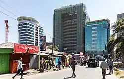
Kirkos (Amharic: ቂርቆስ ክፍለ ከተማ), also spelled Kerkos, Kirikos or Cherkos, is a district of Addis Ababa, Ethiopia. As of 2011 its population was 235,441.[1]
Geography
The district is located in the city centre, and borders the districts of Arada, Yeka, Bole, Nifas Silk-Lafto and Lideta.
Education
There are many schools in the area. Popular examples include the African Union Branch (Grades 1-8) of Nejashi Ethio-Turkish International Schools,[2] Blue Bird School, and multiple others.[3]
List of neighbourhoods
- Bantyiketu
- Beg Tera
- Beherawi
- Beklo Bet
- Bulgariya Sefer
- Enderase
- Gotera
- Kasanchis
- Kera
- Lancha
- Legehar
- Menaheriya Kasanchis
- Meshualekiya
- Meskel Flower
- Mexico
- Olympia
- Riche
- Sar Bet
- Wello Sefer
See also
- Meskel Square
- Addis Ababa railway station
References
- 1 2 3 "Kirkos Archived 2013-12-03 at the Wayback Machine". City Government of Addis Ababa.
- ↑ "African Union Branch." Nejashi Ethio-Turkish International Schools. Retrieved on October 19, 2015.
- ↑ https://www.google.com/maps/search/Kirkos,+Addis+Ababa,+Ethiopia+school/@8.9993278,38.7423599,15.29z?entry=ttu
External links
- Google. "Kirkos" (Map). Google Maps. Google.
| History | |||||
|---|---|---|---|---|---|
| Districts | |||||
| Squares | |||||
| Transport | |||||
| Landmarks | |||||
| Education |
| ||||
This article is issued from Wikipedia. The text is licensed under Creative Commons - Attribution - Sharealike. Additional terms may apply for the media files.