Goesan
괴산군 | |
|---|---|
| Korean transcription(s) | |
| • Hangul | 괴산군 |
| • Hanja | 槐山郡 |
| • Revised Romanization | Goesan-gun |
| • McCune-Reischauer | Koesan-gun |
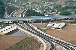 No.3 National highway and overpassing Jungbu Inland Expressway | |
 Flag Emblem of Goesan | |
 Location in South Korea | |
| Country | |
| Region | Hoseo |
| Administrative divisions | 1 eup and 10 myeon |
| Area | |
| • Total | 842 km2 (325 sq mi) |
| Population | |
| • Total | 44,461 |
| • Density | 52.8/km2 (137/sq mi) |
| • Dialect | Chungcheong |
Goesan County (Goesan-gun) is a county in North Chungcheong Province, South Korea.
Demographics
As of 2021, Goesan-gun has a population of about 40,000 people.[1] The area has been affected strongly by the graying of the South Korean population, and more than a third of residents are over the age of 65.[1] Schools have closed as urbanization and falling birthrates in Korea have resulted in a declining number of children to attend them.[1] One school, to prevent closure due to low enrollment, offers free housing to families with school-age children.[1]
Tourist spot
- Sanmagi-yetgil
Sanmagi-yetgil is a 5 km (3.1 mi) road that extends from Sao-rang-maeul village (Oe-sa-ri, Chilseong-myeon, Goesan-gun, Chungbuk) to Sanmagi village in the mountains. It is a stroll path restored to resemble the traditional mountain road with a picturesque landscape.[2]
Twin towns – sister cities
Goesan is twinned with:
Domestic
International
Climate
Goesan has a monsoon-influenced humid continental climate (Köppen: Dwa) with cold, dry winters and hot, rainy summers.
| Climate data for Goesan (1993–2020 normals) | |||||||||||||
|---|---|---|---|---|---|---|---|---|---|---|---|---|---|
| Month | Jan | Feb | Mar | Apr | May | Jun | Jul | Aug | Sep | Oct | Nov | Dec | Year |
| Mean daily maximum °C (°F) | 2.9 (37.2) |
6.1 (43.0) |
12.2 (54.0) |
19.0 (66.2) |
24.4 (75.9) |
27.7 (81.9) |
29.2 (84.6) |
30.0 (86.0) |
25.8 (78.4) |
20.2 (68.4) |
12.6 (54.7) |
4.8 (40.6) |
17.9 (64.2) |
| Daily mean °C (°F) | −3.5 (25.7) |
−0.6 (30.9) |
5.0 (41.0) |
11.5 (52.7) |
17.2 (63.0) |
21.6 (70.9) |
24.5 (76.1) |
24.8 (76.6) |
19.4 (66.9) |
12.3 (54.1) |
5.5 (41.9) |
−1.6 (29.1) |
11.3 (52.3) |
| Mean daily minimum °C (°F) | −9.2 (15.4) |
−6.6 (20.1) |
−1.7 (28.9) |
4.3 (39.7) |
10.4 (50.7) |
16.0 (60.8) |
20.7 (69.3) |
20.7 (69.3) |
14.8 (58.6) |
6.6 (43.9) |
−0.3 (31.5) |
−7.1 (19.2) |
5.7 (42.3) |
| Average precipitation mm (inches) | 21.6 (0.85) |
33.6 (1.32) |
47.5 (1.87) |
87.5 (3.44) |
84.9 (3.34) |
140.2 (5.52) |
309.1 (12.17) |
285.3 (11.23) |
142.8 (5.62) |
60.6 (2.39) |
50.2 (1.98) |
23.4 (0.92) |
1,286.7 (50.66) |
| Average precipitation days (≥ 0.1 mm) | 4.9 | 4.9 | 6.9 | 7.5 | 7.4 | 7.8 | 14.4 | 13.3 | 8.5 | 5.2 | 6.9 | 5.9 | 93.6 |
| Source: Korea Meteorological Administration[3] | |||||||||||||
See also
References
- 1 2 3 4 Kim, Victoria (2021-07-16). "Next stop, a town at risk of disappearing. Please, watch your bones". Los Angeles Times. Retrieved 2021-07-18.
- ↑ JoongAng Daily http://news.joins.com/article/21920410
- ↑ "Climatological Normals of Korea (1991 ~ 2020)" (PDF) (in Korean). Korea Meteorological Administration. Archived from the original (PDF) on 29 January 2022. Retrieved 7 June 2023.
External links

36°48′39″N 127°47′41″E / 36.8108333433°N 127.794722232°E