Honbetsu
本別町 | |
|---|---|
Town | |
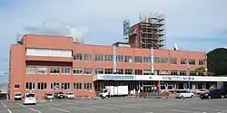 Honbetsu town hall | |
 Flag  Emblem | |
 Location of Honbetsu in Hokkaido (Tokachi Subprefecture) | |
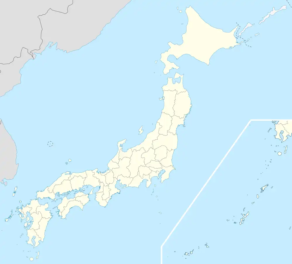 Honbetsu Location in Japan | |
| Coordinates: 43°7′N 143°37′E / 43.117°N 143.617°E | |
| Country | Japan |
| Region | Hokkaido |
| Prefecture | Hokkaido (Tokachi Subprefecture) |
| District | Nakagawa (Tokachi) |
| Area | |
| • Total | 391.99 km2 (151.35 sq mi) |
| Population (September 30, 2016) | |
| • Total | 7,441 |
| • Density | 19/km2 (49/sq mi) |
| Time zone | UTC+09:00 (JST) |
| Climate | Dfb |
| Website | www |
Honbetsu (本別町, Honbetsu-chō) is a town located in Tokachi Subprefecture, Hokkaido, Japan.
As of September 2016, the town has an estimated population of 7,441 and a density of 19 persons per km2. The total area is 391.99 km2.
Climate
| Climate data for Honbetsu (1991−2020 normals, extremes 1976−present) | |||||||||||||
|---|---|---|---|---|---|---|---|---|---|---|---|---|---|
| Month | Jan | Feb | Mar | Apr | May | Jun | Jul | Aug | Sep | Oct | Nov | Dec | Year |
| Record high °C (°F) | 7.4 (45.3) |
11.6 (52.9) |
17.2 (63.0) |
30.9 (87.6) |
37.2 (99.0) |
35.6 (96.1) |
37.1 (98.8) |
36.3 (97.3) |
33.7 (92.7) |
26.7 (80.1) |
21.1 (70.0) |
14.7 (58.5) |
37.2 (99.0) |
| Mean daily maximum °C (°F) | −1.5 (29.3) |
−0.3 (31.5) |
4.5 (40.1) |
11.9 (53.4) |
18.0 (64.4) |
21.4 (70.5) |
24.5 (76.1) |
25.4 (77.7) |
21.9 (71.4) |
15.8 (60.4) |
8.2 (46.8) |
0.7 (33.3) |
12.5 (54.6) |
| Daily mean °C (°F) | −8.9 (16.0) |
−7.3 (18.9) |
−1.1 (30.0) |
5.4 (41.7) |
11.2 (52.2) |
15.2 (59.4) |
18.9 (66.0) |
20.0 (68.0) |
16.2 (61.2) |
9.4 (48.9) |
2.4 (36.3) |
−5.5 (22.1) |
6.3 (43.4) |
| Mean daily minimum °C (°F) | −16.1 (3.0) |
−14.9 (5.2) |
−6.9 (19.6) |
−0.5 (31.1) |
5.1 (41.2) |
10.2 (50.4) |
14.6 (58.3) |
15.9 (60.6) |
11.5 (52.7) |
3.7 (38.7) |
−2.7 (27.1) |
−11.7 (10.9) |
0.7 (33.2) |
| Record low °C (°F) | −29.1 (−20.4) |
−27.4 (−17.3) |
−24.8 (−12.6) |
−12.4 (9.7) |
−4.3 (24.3) |
−0.4 (31.3) |
4.9 (40.8) |
5.3 (41.5) |
0.3 (32.5) |
−6.3 (20.7) |
−17.8 (0.0) |
−26.8 (−16.2) |
−29.1 (−20.4) |
| Average precipitation mm (inches) | 29.2 (1.15) |
18.9 (0.74) |
32.4 (1.28) |
54.2 (2.13) |
78.4 (3.09) |
67.0 (2.64) |
100.1 (3.94) |
132.4 (5.21) |
118.0 (4.65) |
79.4 (3.13) |
42.9 (1.69) |
37.5 (1.48) |
790.6 (31.13) |
| Average snowfall cm (inches) | 67 (26) |
56 (22) |
59 (23) |
15 (5.9) |
1 (0.4) |
0 (0) |
0 (0) |
0 (0) |
0 (0) |
0 (0) |
12 (4.7) |
65 (26) |
276 (109) |
| Average precipitation days (≥ 1.0 mm) | 4.7 | 4.2 | 5.8 | 8.3 | 9.8 | 9.2 | 10.0 | 10.9 | 10.1 | 8.3 | 7.1 | 6.2 | 94.6 |
| Average snowy days | 7.9 | 7.5 | 8.0 | 2.0 | 0.1 | 0 | 0 | 0 | 0 | 0 | 1.5 | 7.5 | 34.5 |
| Mean monthly sunshine hours | 177.2 | 178.5 | 206.5 | 185.3 | 177.6 | 150.2 | 125.6 | 127.5 | 140.6 | 164.1 | 160.1 | 161.9 | 1,954.9 |
| Source: JMA[1][2] | |||||||||||||
Mascot

Genki-kun, the town's mascot
Honbetsu's mascot is Genki-kun (元気くん). He is a soybean filled with dynamism and easiness. He is unveiled in 2001. His quote "Ii hito iimachi ikiikihonbetsu" (いいひと いいまち いきいきほんべつ) is a tongue twister.[3]
References
- ↑ 観測史上1~10位の値(年間を通じての値). JMA. Retrieved February 24, 2022.
- ↑ 気象庁 / 平年値(年・月ごとの値). JMA. Retrieved February 24, 2022.
- ↑ "元気くん紹介". Honbetsu.
External links
 Media related to Honbetsu, Hokkaidō at Wikimedia Commons
- Official Website (in Japanese)
| ||||||||||||
| ||||||||||||
| ||||||||||||
| ||||||||||||
| ||||||||||||
| ||||||||||||
| ||||||||||||
| ||||||||||||
| ||||||||||||
| ||||||||||||
| ||||||||||||
| ||||||||||||
| ||||||||||||
| ||||||||||||
This article is issued from Wikipedia. The text is licensed under Creative Commons - Attribution - Sharealike. Additional terms may apply for the media files.