Sankt Oswald ob Eibiswald | |
|---|---|
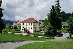 View of Sankt Oswald ob Eibiswald | |
 Coat of arms | |
 Sankt Oswald ob Eibiswald Location within Austria | |
| Coordinates: 46°42′30″N 15°08′48″E / 46.70833°N 15.14667°E | |
| Country | Austria |
| State | Styria |
| District | Deutschlandsberg |
| Government | |
| • Mayor | Günter Koinegg (SPÖ) |
| Area | |
| • Total | 22.43 km2 (8.66 sq mi) |
| Elevation | 747 m (2,451 ft) |
| Population (2014-01-01) | |
| • Total | 562 |
| • Density | 25/km2 (65/sq mi) |
| Time zone | UTC+1 (CET) |
| • Summer (DST) | UTC+2 (CEST) |
| Postal code | 8553 |
| Area code | 03468 |
| Vehicle registration | DL |
| Website | www.oswald-o-e.at |
Sankt Oswald ob Eibiswald was a municipality in Austria which merged in January 2015 into Eibiswald in the Deutschlandsberg District in the Austrian state of Styria.
Population
| Year | Pop. | ±% |
|---|---|---|
| 1869 | 723 | — |
| 1880 | 755 | +4.4% |
| 1890 | 712 | −5.7% |
| 1900 | 731 | +2.7% |
| 1910 | 806 | +10.3% |
| 1923 | 779 | −3.3% |
| 1934 | 774 | −0.6% |
| 1939 | 820 | +5.9% |
| 1951 | 896 | +9.3% |
| 1961 | 814 | −9.2% |
| 1971 | 823 | +1.1% |
| 1981 | 747 | −9.2% |
| 1991 | 701 | −6.2% |
| 2001 | 641 | −8.6% |
| 2011 | 580 | −9.5% |
| 2014 | 562 | −3.1% |
References
This article is issued from Wikipedia. The text is licensed under Creative Commons - Attribution - Sharealike. Additional terms may apply for the media files.