Willem Dreeslaan | |||||||||||
|---|---|---|---|---|---|---|---|---|---|---|---|
.JPG.webp) | |||||||||||
| General information | |||||||||||
| Location | Netherlands | ||||||||||
| Coordinates | 52°03′55″N 4°32′07″E / 52.06528°N 4.53528°E | ||||||||||
| Platforms | 2 | ||||||||||
| History | |||||||||||
| Opened | 29 October 2006 | ||||||||||
| Services | |||||||||||
| |||||||||||
| Location | |||||||||||
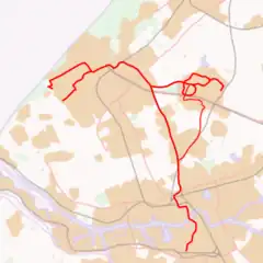 Willem Dreeslaan Location within RandstadRail network | |||||||||||
Willem Dreeslaan is a RandstadRail station in Zoetermeer, the Netherlands.
History
The station opened on 29 October 2006, as part of the Oosterheemlijn (Seghwaert - Javalaan). The station is on a viaduct along the Aletta Jacobslaan at the junction with Willem Dreeslaan.
Train services
The following services currently call at Willem Dreeslaan:
| Service | Route | Material | Frequency |
|---|---|---|---|
| RR4 | De Uithof - Beresteinaan - Bouwlustlaan - De Rade - Dedemsvaart - Zuidwoldepad - Leyenburg - Monnickendamplein - Tienhovenselaan - Dierenselaan - De La Reyweg - Monstersestraat - MCH Westeinde - Brouwersgracht - Grote Markt - Spui - Den Haag Centraal - Beatrixkwartier - Laan van NOI - Voorburg 't Loo - Leidschendam-Voorburg - Forepark - Leidschenveen - Voorweg (Low Level) - Centrum West - Stadhuis - Palenstein - Seghwaert - Willem Dreeslaan - Oosterheem - Javalaan | HTM RegioCitadis Tram | 6x per hour (Monday - Saturday, Every 10 Minutes), 5x per hour (Sundays, Every 12 Minutes), 4x per hour (Evenings, after 8pm, Every 15 Minutes) |
Bus services
- 165 (Centrum West RR - Palenstein RR - Willem Dreeslaan RR - Benthuizen - Hazerwoude - Hazerwoude Rijndijk - Alphen a/d Rijn NS) - Arriva
- 565 (Centrum West RR - Palenstein RR - Willem Dreeslaan RR - Benthuizen - Hazerwoude - Hazerwoude Rijndijk - Alphen a/d Rijn NS) - Arriva
Gallery
 RandstadRail Network Map
 A RegioCitadis on RR4
 An RET Metro set that was converted for RandstadRail operation.
 A new RET RandstadRail set, which replaced the Metro sets.
 View to station Willem Dreeslaan
.JPG.webp) Stairs and Lift, with bus stop in foreground.
Stairs and Lift, with bus stop in foreground..JPG.webp) The station from street level.
The station from street level.
This article is issued from Wikipedia. The text is licensed under Creative Commons - Attribution - Sharealike. Additional terms may apply for the media files.