Alkamisikely | |
|---|---|
 Alakamisikely | |
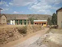
 Alkamisikely Location in Madagascar | |
| Coordinates: 19°13′S 47°11′E / 19.217°S 47.183°E | |
| Country | |
| Region | Itasy |
| District | Arivonimamo |
| Elevation | 1,774 m (5,820 ft) |
| Population (2019)Census | |
| • Total | 3,957 |
| • Ethnicities | Merina |
| Time zone | UTC3 (EAT) |
| Postal code | 112 |
Alkamisikely is a town and commune in Madagascar. It belongs to the district of Arivonimamo District which is a part of Itasy Region. The population of the commune was 3,957 in 2019.
It is situated on the Route d'Interet Provincial 84[2] at 25 km from Arivonimamo.
Only primary schooling is available. The majority 96% of the population of the commune are farmers, while an additional 3% receives their livelihood from raising livestock. The most important crops are rice and potatoes; also beans is an important agricultural product. Services provide employment for 1% of the population.[3]
Following villages belong to the commune of Alkamisikely:
| N° | Village name (Fokontany) | Distance in km from the capital of the commune |
|---|---|---|
| 1 | Ampahimanga | 0 |
| 2 | Imerinatsimo | 14 |
| 3 | Ankamory | 13 |
| 4 | Ambohitringahimainty | 13 |
| 5 | Nangaka | 10 |
| 6 | Ankazotokana | 10 |
| 7 | Ambohibary | 9 |
| 8 | Manjakatompo | 8 |
| 9 | Antanimasaka | 7 |
| 10 | Antanetilava | 7 |
| 11 | Alakamisy Antsampanimahazo | 6,5 |
| 12 | Amboanjobe | 6 |
| 13 | Fisoronana Efadreny | 5,5 |
| 14 | Ambanifahitra | 5 |
References and notes
- ↑ Estimated based on DEM data from Shuttle Radar Topography Mission
- ↑ Route Provinciale 84 : Travaux de réhabilitation sur l’axe Arivonimamo-Manalalondo
- ↑ "ILO census data". Cornell University. 2002. Retrieved 2008-04-23.
Capital: Miarinarivo | ||
| Arivonimamo (22) - 112 |  | |
| Miarinarivo (12) - 117 | ||
| Soavinandriana (15) - 118 | ||
3 districts; 49 communes | ||
19°13′S 47°11′E / 19.217°S 47.183°E
This article is issued from Wikipedia. The text is licensed under Creative Commons - Attribution - Sharealike. Additional terms may apply for the media files.