Azam Warsak
اعظم ورسک | |
|---|---|
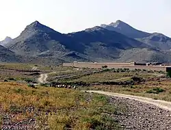 Dramatic scenery of Azam Warsak | |
 Azam Warsak  Azam Warsak | |
| Coordinates: 32°17′15.8″N 69°24′49.5″E / 32.287722°N 69.413750°E | |
| Country | |
| Province | |
| District | South Waziristan |
| Tehsil | Birmal Tehsil |
| Elevation | 1,387 m (4,551 ft) |
| Time zone | UTC+5 (PST) |
| [1] | |
Azam Warsak is a village located in Birmal Tehsil, which is located approximately 20 kilometers west of Wanna.[2][3]
| Latitude: | 32° 17' 15" N |
|---|---|
| Longitude: | 69° 24' 49" E |
| Lat/Long (dec): | 32.28772,69.41375 |
See also
References
- ↑ "Map of Azam Warsak in Federally Administered Tribal Areas, Pakistan". Archived from the original on 10 October 2020. Retrieved 9 October 2020.
- ↑ "NA-50 South Waziristan Agency Area, Map, Candidates and Result". Political, Sports Workers Helpline. Archived from the original on 7 October 2020. Retrieved 7 October 2020.
- ↑ "How far is Azam Warsak from Wana". Distance Calculator. Archived from the original on 9 October 2020. Retrieved 9 October 2020.
This article is issued from Wikipedia. The text is licensed under Creative Commons - Attribution - Sharealike. Additional terms may apply for the media files.