Baodi
宝坻区 Paoti | ||||||||||||||||||||||||||||||||||||||||||||||||
|---|---|---|---|---|---|---|---|---|---|---|---|---|---|---|---|---|---|---|---|---|---|---|---|---|---|---|---|---|---|---|---|---|---|---|---|---|---|---|---|---|---|---|---|---|---|---|---|---|
| Country | People's Republic of China | |||||||||||||||||||||||||||||||||||||||||||||||
| Municipality | Tianjin | |||||||||||||||||||||||||||||||||||||||||||||||
| Township-level divisions | 6 subdistricts 18 towns | |||||||||||||||||||||||||||||||||||||||||||||||
| Population (2017) | 926,700 | |||||||||||||||||||||||||||||||||||||||||||||||
| Time zone | UTC+8 (China Standard) | |||||||||||||||||||||||||||||||||||||||||||||||
| GDP | CNY 63.817 billion(2018) | |||||||||||||||||||||||||||||||||||||||||||||||
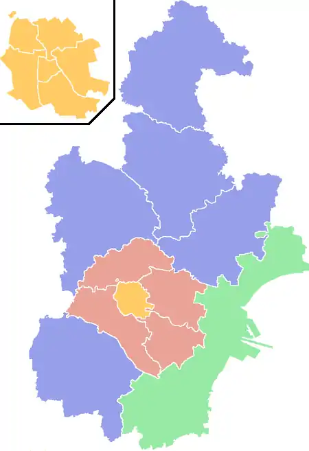
| Tianjin district map |
| |||||||||||||||||||||||||||||||||||||||||||||||
| Website | http://www.tjbd.gov.cn/ | |||||||||||||||||||||||||||||||||||||||||||||||
Baodi District (simplified Chinese: 宝坻区; traditional Chinese: 寶坻區; pinyin: Bǎodí Qū) is a district of the municipality of Tianjin, People's Republic of China.[1]
Transport
Rail
Station
 Baodi
Baodi- Baodi South
- Dakoutun
- jingjinxincheng
Railway
- Tianjin–Jizhou railway
- Beijing–Tangshan intercity railway
- Beijing–Binhai intercity railway
- Tianjin-Chengde Intercity Railway
Roads and Expressways
The following three expressways of China run in or through Baodi:
- Beijing–Harbin Expressway
- Jinji Expressway
- Tangcheng Expressway
The following two China National Highways pass through Tianjin:
- China National Highway 233
- China National Highway 509
Administrative divisions
There are 8 subdistricts and 16 towns in the district:[2]
| Name | Chinese (S) | Hanyu Pinyin | Population (2010)[3][4] | Area (km2) |
|---|---|---|---|---|
| Baoping Subdistrict | 宝平街道 | Bǎopíng Jiēdào | 97,164 | |
| Haibin Subdistrict | 海滨街道 | Hǎibīn Jiēdào | 55,821 | 118 |
| Yuhua Subdistrict | 钰华街道 | Yùhuá Jiēdào | 48,825 | |
| Zhouliang Subdistrict | 周良街道 | Zhōuliáng Jiēdào | 12,144 | 45 |
| Koudong town | 口东镇 | Kǒudōng Jiēdào | 29,181 | 31 |
| Dabaizhuang town | 大白庄镇 | Dàbáizhuāng Jiēdào | 18,139 | 81.6 |
| Chaoyang Subdistrict | 潮阳街道 | Cháoyáng Jiēdào | 30,090 | |
| Zhaoxia Subdistrict | 朝霞街道 | Zhāoxiá Jiēdào | 39,941 | 26 |
| Dakoutun town | 大口屯镇 | Dàkǒu Zhèn | 56,526 | 88.2 |
| Nanrenfu | 南仁垺乡 | Nánrénfú Xiāng | merged with Dakoutun[5] | |
| Xinkaikou town | 新开口镇 | Xīnkāikǒu Zhèn | 25,748 | 36 |
| Haogezhuang town | 郝各庄镇 | Hǎogè Zhèn | 18,752 | 15 |
| Niudaokou town | 牛道口镇 | Niúdàokǒu Zhèn | 47,168 | |
| Xin'an town | 新安镇 | Xīn'ān Zhèn | 30,783 | 28 |
| Dazhongzhuang town | 大钟庄镇 | Dàzhōngzhuāng Zhèn | 36,406 | 100 |
| Wangbozhuang town | 王卜庄镇 | Wángbozhuāng Zhèn | 32,301 | 39.2 |
| Fangjiazhuang town | 方家庄镇 | Fāngjiāzhuāng Zhèn | 30,338 | 28 |
| Bamencheng town | 八门城镇 | Bāménchéng Zhèn | 25,325 | 60 |
| Zhangezhuang town | 霍各庄镇 | Huògèzhuāng Zhèn | 26,607 | 33 |
| Lintingkou town | 林亭口镇 | Líntíngkǒu Zhèn | 31,810 | 42 |
| Datangzhuang town | 大唐庄镇 | Dàtángzhuāng Zhèn | 13,512 | |
| Shigezhuang town | 史各庄镇 | Shǐgèzhuāng Zhèn | 25,783 | 34 |
| Huangzhuang town | 黄庄真 | Huángzhuāng Zhèn | 11,475 | 112 |
| Erwangzhuang town | 尔王庄镇 | Ěrwángzhuāng Zhèn | 13,120 | 53 |
| Niujiapai town | 牛家牌镇 | Niújiāpái Zhèn | 16,755 | 52 |
| industrial & farming zones | 25,443 |
Climate
| Climate data for Baodi District (1991–2020 normals, extremes 1981–2010) | |||||||||||||
|---|---|---|---|---|---|---|---|---|---|---|---|---|---|
| Month | Jan | Feb | Mar | Apr | May | Jun | Jul | Aug | Sep | Oct | Nov | Dec | Year |
| Record high °C (°F) | 13.8 (56.8) |
20.0 (68.0) |
29.0 (84.2) |
32.3 (90.1) |
38.0 (100.4) |
39.1 (102.4) |
40.8 (105.4) |
36.4 (97.5) |
35.8 (96.4) |
30.1 (86.2) |
20.9 (69.6) |
13.9 (57.0) |
40.8 (105.4) |
| Mean daily maximum °C (°F) | 1.8 (35.2) |
5.7 (42.3) |
12.8 (55.0) |
20.6 (69.1) |
26.6 (79.9) |
30.3 (86.5) |
31.4 (88.5) |
30.4 (86.7) |
26.3 (79.3) |
19.2 (66.6) |
9.9 (49.8) |
3.1 (37.6) |
18.2 (64.7) |
| Daily mean °C (°F) | −4.4 (24.1) |
−0.8 (30.6) |
6.2 (43.2) |
14.1 (57.4) |
20.1 (68.2) |
24.3 (75.7) |
26.5 (79.7) |
25.2 (77.4) |
20.1 (68.2) |
12.6 (54.7) |
3.9 (39.0) |
−2.5 (27.5) |
12.1 (53.8) |
| Mean daily minimum °C (°F) | −9.2 (15.4) |
−6.2 (20.8) |
0.1 (32.2) |
7.6 (45.7) |
13.5 (56.3) |
18.7 (65.7) |
22.2 (72.0) |
20.9 (69.6) |
14.8 (58.6) |
7.0 (44.6) |
−1.0 (30.2) |
−7.0 (19.4) |
6.8 (44.2) |
| Record low °C (°F) | −23.3 (−9.9) |
−18.6 (−1.5) |
−11.5 (11.3) |
−2.7 (27.1) |
3.9 (39.0) |
9.4 (48.9) |
15.3 (59.5) |
11.3 (52.3) |
4.2 (39.6) |
−5.5 (22.1) |
−11.8 (10.8) |
−18.6 (−1.5) |
−23.3 (−9.9) |
| Average precipitation mm (inches) | 2.4 (0.09) |
4.2 (0.17) |
6.6 (0.26) |
19.4 (0.76) |
35.4 (1.39) |
75.9 (2.99) |
173.1 (6.81) |
123.3 (4.85) |
53.5 (2.11) |
31.2 (1.23) |
14.6 (0.57) |
2.7 (0.11) |
542.3 (21.34) |
| Average precipitation days (≥ 0.1 mm) | 1.2 | 1.9 | 2.6 | 4.4 | 5.6 | 9.6 | 11.3 | 9.1 | 6.5 | 4.6 | 3.0 | 1.6 | 61.4 |
| Average snowy days | 2.3 | 2.2 | 0.9 | 0.1 | 0 | 0 | 0 | 0 | 0 | 0 | 1.6 | 2.8 | 9.9 |
| Average relative humidity (%) | 50 | 49 | 47 | 49 | 55 | 64 | 76 | 79 | 74 | 68 | 62 | 55 | 61 |
| Mean monthly sunshine hours | 178.7 | 181.7 | 225.8 | 236.2 | 258.9 | 218.5 | 188.3 | 205.1 | 207.7 | 197.7 | 165.3 | 172.0 | 2,435.9 |
| Percent possible sunshine | 59 | 60 | 61 | 59 | 58 | 49 | 42 | 49 | 56 | 58 | 56 | 59 | 56 |
| Source: China Meteorological Administration[6][7] | |||||||||||||
References
- ↑ "Illustrated Discussion on Coastal Defenses". World Digital Library. Retrieved 9 May 2013.
- ↑ 2011年统计用区划代码和城乡划分代码:宝坻区 (in Chinese). National Bureau of Statistics of the People's Republic of China. Archived from the original on 1 October 2012. Retrieved 8 August 2013.
- ↑ Census Office of the State Council of the People's Republic of China; Population and Employment Statistics Division of the National Bureau of Statistics of the People's Republic of China (2012). 中国2010人口普查分乡、镇、街道资料 (1 ed.). Beijing: China Statistics Print. ISBN 978-7-5037-6660-2.
- ↑ "Archived copy". Archived from the original on 8 December 2017. Retrieved 8 December 2017.
{{cite web}}: CS1 maint: archived copy as title (link) - ↑ 大口屯镇 [Dakoutun Town] (in Chinese). XZQH. 7 March 2014. Retrieved 8 December 2017.
2001?年,撤销南仁垺乡,并入大口屯镇。
- ↑ 中国气象数据网 – WeatherBk Data (in Simplified Chinese). China Meteorological Administration. Retrieved 10 October 2023.
- ↑ 中国气象数据网 (in Simplified Chinese). China Meteorological Administration. Retrieved 10 October 2023.
| Districts |  | |
|---|---|---|
| Defunct Districts | ||
39°43′02″N 117°18′36″E / 39.7172°N 117.31°E
This article is issued from Wikipedia. The text is licensed under Creative Commons - Attribution - Sharealike. Additional terms may apply for the media files.