Bemis, West Virginia | |
|---|---|
 Bemis, West Virginia  Bemis, West Virginia | |
| Coordinates: 38°48′43″N 79°44′20″W / 38.81194°N 79.73889°W | |
| Country | United States |
| State | West Virginia |
| County | Randolph |
| Elevation | 2,582 ft (787 m) |
| Time zone | UTC-5 (Eastern (EST)) |
| • Summer (DST) | UTC-4 (EDT) |
| Area codes | 304 & 681 |
| GNIS feature ID | 1553855[1] |
Bemis is an unincorporated community in Randolph County, West Virginia, United States. It is located on Shavers Fork, along County Route 22, some 9.8 miles (15.8 km) southeast of Elkins.[2]
The community has the name of Harry Bemis, a businessperson in the lumber industry.[3]
References
- 1 2 U.S. Geological Survey Geographic Names Information System: Bemis
- ↑ Randolph County, West Virginia General Highway Map (PDF) (Map). West Virginia Department of Transportation. 2011. p. 4. Archived from the original (PDF) on April 25, 2012. Retrieved November 10, 2011.
- ↑ Kenny, Hamill (1945). West Virginia Place Names: Their Origin and Meaning, Including the Nomenclature of the Streams and Mountains. Piedmont, WV: The Place Name Press. p. 105.
Municipalities and communities of Randolph County, West Virginia, United States | ||
|---|---|---|
| City | 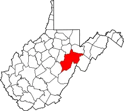 Map of West Virginia highlighting Randolph County | |
| Towns | ||
| CDPs | ||
| Other communities |
| |
| Ghost towns | ||
| Footnotes | ‡This populated place also has portions in an adjacent county or counties | |
This article is issued from Wikipedia. The text is licensed under Creative Commons - Attribution - Sharealike. Additional terms may apply for the media files.