Bouchevilliers | |
|---|---|
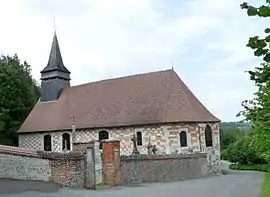 The church in Bouchevilliers | |
Location of Bouchevilliers | |
 Bouchevilliers  Bouchevilliers | |
| Coordinates: 49°24′14″N 1°42′56″E / 49.4039°N 1.7156°E | |
| Country | France |
| Region | Normandy |
| Department | Eure |
| Arrondissement | Les Andelys |
| Canton | Romilly-sur-Andelle |
| Intercommunality | CC 4 rivières |
| Government | |
| • Mayor (2020–2026) | Emmanuel Broux[1] |
| Area 1 | 4.31 km2 (1.66 sq mi) |
| Population | 76 |
| • Density | 18/km2 (46/sq mi) |
| Time zone | UTC+01:00 (CET) |
| • Summer (DST) | UTC+02:00 (CEST) |
| INSEE/Postal code | 27098 /27150 |
| Elevation | 73–195 m (240–640 ft) (avg. 81 m or 266 ft) |
| 1 French Land Register data, which excludes lakes, ponds, glaciers > 1 km2 (0.386 sq mi or 247 acres) and river estuaries. | |
Bouchevilliers (French pronunciation: [buʃvilje]) is a commune in the Eure department in Normandy in north-western France.
Population
| Year | Pop. | ±% p.a. |
|---|---|---|
| 1968 | 62 | — |
| 1975 | 60 | −0.47% |
| 1982 | 63 | +0.70% |
| 1990 | 45 | −4.12% |
| 1999 | 52 | +1.62% |
| 2009 | 75 | +3.73% |
| 2014 | 76 | +0.27% |
| 2020 | 79 | +0.65% |
| Source: INSEE[3] | ||
See also
References
- ↑ "Répertoire national des élus: les maires". data.gouv.fr, Plateforme ouverte des données publiques françaises (in French). 2 December 2020.
- ↑ "Populations légales 2021". The National Institute of Statistics and Economic Studies. 28 December 2023.
- ↑ Population en historique depuis 1968, INSEE
Wikimedia Commons has media related to Bouchevilliers.
This article is issued from Wikipedia. The text is licensed under Creative Commons - Attribution - Sharealike. Additional terms may apply for the media files.