| Cap de Boumort | |
|---|---|
 View from the summit | |
| Highest point | |
| Elevation | 2,075 m (6,808 ft) |
| Prominence | 653 m (2,142 ft) |
| Isolation | 19.17 km (11.91 mi) to tossal de l'Àliga |
| Coordinates | 42°14′6″N 1°8′5″E / 42.23500°N 1.13472°E |
| Geography | |
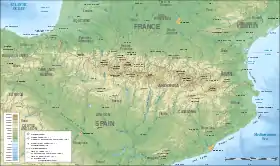 Cap de Boumort Location in the Pyrenees | |
| Location | Catalonia, Spain |
| Parent range | Serra de Boumort |
Cap de Boumort is a mountain of Catalonia, Spain. It has an elevation of 2,075 metres above sea level.[1]
It is the highest summit of the Serra de Boumort range in the Pre-Pyrenees.
See also
References
- ↑ "Mapa Topogràfic de Catalunya". Institut Cartogràfic de Catalunya. Retrieved May 22, 2010..
This article is issued from Wikipedia. The text is licensed under Creative Commons - Attribution - Sharealike. Additional terms may apply for the media files.