Chandolas | |
|---|---|
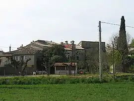 A general view of Chandolas | |
Location of Chandolas | |
 Chandolas  Chandolas | |
| Coordinates: 44°24′16″N 4°15′12″E / 44.4044°N 4.2533°E | |
| Country | France |
| Region | Auvergne-Rhône-Alpes |
| Department | Ardèche |
| Arrondissement | Largentière |
| Canton | Les Cévennes ardéchoises |
| Intercommunality | Pays Beaume Drobie |
| Government | |
| • Mayor (2020–2026) | Jean-François Thibon[1] |
| Area 1 | 11.63 km2 (4.49 sq mi) |
| Population | 543 |
| • Density | 47/km2 (120/sq mi) |
| Time zone | UTC+01:00 (CET) |
| • Summer (DST) | UTC+02:00 (CEST) |
| INSEE/Postal code | 07053 /07230 |
| Elevation | 105–242 m (344–794 ft) (avg. 130 m or 430 ft) |
| 1 French Land Register data, which excludes lakes, ponds, glaciers > 1 km2 (0.386 sq mi or 247 acres) and river estuaries. | |
Chandolas is a commune in the Ardèche department in southern France.
Population
| Year | Pop. | ±% p.a. |
|---|---|---|
| 1968 | 411 | — |
| 1975 | 394 | −0.60% |
| 1982 | 383 | −0.40% |
| 1990 | 366 | −0.57% |
| 1999 | 342 | −0.75% |
| 2007 | 438 | +3.14% |
| 2012 | 482 | +1.93% |
| 2017 | 506 | +0.98% |
| Source: INSEE[3] | ||
See also
References
- ↑ "Répertoire national des élus: les maires". data.gouv.fr, Plateforme ouverte des données publiques françaises (in French). 9 August 2021.
- ↑ "Populations légales 2021". The National Institute of Statistics and Economic Studies. 28 December 2023.
- ↑ Population en historique depuis 1968, INSEE
Wikimedia Commons has media related to Chandolas.
This article is issued from Wikipedia. The text is licensed under Creative Commons - Attribution - Sharealike. Additional terms may apply for the media files.