Deh | |
|---|---|
Tehsil | |
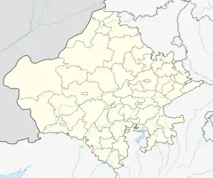 Deh Location in Rajasthan, India  Deh Deh (India) | |
| Coordinates: 27°18′N 73°54′E / 27.30°N 73.90°E | |
| Country | |
| State | Rajasthan |
| District | Nagaur |
| Population (2011) | |
| • Total | Approximately 10,000+ |
| Languages | |
| • Official | Hindi |
| Time zone | UTC+5:30 (IST) |
| PIN | 341022 |
| ISO 3166 code | RJ-21 |
| Vehicle registration | RJ- |
Deh is a Tehsil in Nagaur district of Rajasthan India
The town Deh is situated at Nagaur-Ladnun National Highway-58, 20 km away from Nagaur
Geography
Deh is located at 27°18′N 73°54′E / 27.30°N 73.90°E.[1] It has an average elevation of 292 metres (958 feet).
Demographics
As of 2011 India census,[2] Deh had a population of 10000+.[3]
Temples
Kunjal Mata Temple[4] of goddess Kunjal is located in Deh village of Jayal tehsil in Nagaur district of Rajasthan, India, and 1.3 km away from Deh's Bus Station on Nagaur-Ladnun National Highway-65.
- Sri Jain goshala, a state of art cow shelter built and maintained by Sri anat goraksha samiti
- Kunjal Mata[5] is kul devi of Pareek Brahmin's (Joshi Sakraniya and many other Pareek gotras). Temple area is 38 Bigha. It is A Historical Place[6] of Rajasthan.
- Old Cenatops and Sati Mata Chabutra of former Rulers of Udawat Rajputs Near Talab (Water Lake).
- Karni Mata Temple Near Talab (Built by Shri Gopal Singh Ji Udawat S/o Late Kamdar Thk. Shri Dhonkal Singh Ji Udawat).
- Jain Temple and Nasiyan.
- Bibi Mai Mosque (500 Meters from Village Bus Stand) This is a historical & holy place for Muslims.
Caste Factor
Schedule Caste (SC) constitutes 20.84% while Schedule Tribe (ST) were 0.04% of total population in Deh village.
Work Profile
In Deh village out of total population, 4425 were engaged in work activities. 59.64% of workers describe their work as Main Work (Employment or Earning more than 6 Months) while 40.36% were involved in Marginal activity providing livelihood for less than 6 months. Of 4425 workers engaged in Main Work, 1549 were cultivators (owner or co-owner) while 472 were Agricultural laborer.
References
- ↑ Falling Rain Genomics, Inc - Deh
- ↑ "Census of India 2001: Data from the 2001 Census, including cities, villages and towns (Provisional)". Census Commission of India. Archived from the original on 16 June 2004. Retrieved 1 November 2008.
- ↑ Deh on Censusindia.gov.in
- ↑ Kunjal Mata Temple on Wikipedia
- ↑ Kunjal Mata Temple on wikimapia
- ↑ Kunjal Mata Mandir Archived 2010-07-18 at the Wayback Machine
External links