Dobersberg | |
|---|---|
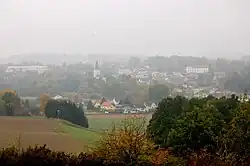 Dobersberg seen from the east | |
 Coat of arms | |
 Dobersberg Location within Austria | |
| Coordinates: 48°54′54″N 15°19′15″E / 48.91500°N 15.32083°E | |
| Country | Austria |
| State | Lower Austria |
| District | Waidhofen an der Thaya |
| Government | |
| • Mayor | Franz Traxler (ÖVP) |
| Area | |
| • Total | 47.59 km2 (18.37 sq mi) |
| Elevation | 465 m (1,526 ft) |
| Population (2018-01-01)[2] | |
| • Total | 1,618 |
| • Density | 34/km2 (88/sq mi) |
| Time zone | UTC+1 (CET) |
| • Summer (DST) | UTC+2 (CEST) |
| Postal code | 3843 |
| Area code | 02843 |
| Vehicle registration | WT |
| Website | www.dobersberg.gv.at |
Dobersberg is a municipality in the district of Waidhofen an der Thaya in the Austrian state of Lower Austria.
Population
| Year | Pop. | ±% |
|---|---|---|
| 1971 | 1,935 | — |
| 1981 | 1,897 | −2.0% |
| 1991 | 1,801 | −5.1% |
| 2001 | 1,743 | −3.2% |
References
- ↑ "Dauersiedlungsraum der Gemeinden Politischen Bezirke und Bundesländer - Gebietsstand 1.1.2018". Statistics Austria. Retrieved 10 March 2019.
- ↑ "Einwohnerzahl 1.1.2018 nach Gemeinden mit Status, Gebietsstand 1.1.2018". Statistics Austria. Retrieved 9 March 2019.
External links
Wikimedia Commons has media related to Dobersberg.
This article is issued from Wikipedia. The text is licensed under Creative Commons - Attribution - Sharealike. Additional terms may apply for the media files.