Hajr District
مديرية حجر | |
|---|---|
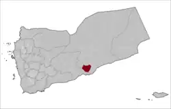 The district highlighted in Yemen | |
| Coordinates: 14°20′N 48°20′E / 14.333°N 48.333°E | |
| Country | |
| Governorate | Hadhramaut |
| Population (2003) | |
| • Total | 25,566 |
| Time zone | UTC+3 (Yemen Standard Time) |
Hajr District (Arabic: مديرية حجر) is a district of the Hadhramaut Governorate, Yemen. As of 2003, the district had a population of 25,566 inhabitants.[1]
Climate
| Climate data for Hajr | |||||||||||||
|---|---|---|---|---|---|---|---|---|---|---|---|---|---|
| Month | Jan | Feb | Mar | Apr | May | Jun | Jul | Aug | Sep | Oct | Nov | Dec | Year |
| Mean daily maximum °C (°F) | 19.3 (66.7) |
20.3 (68.5) |
22.1 (71.8) |
23.6 (74.5) |
25.7 (78.3) |
27.1 (80.8) |
25.9 (78.6) |
25.2 (77.4) |
24.4 (75.9) |
22.8 (73.0) |
20.7 (69.3) |
19.5 (67.1) |
23.1 (73.5) |
| Mean daily minimum °C (°F) | 7.1 (44.8) |
8.4 (47.1) |
10.5 (50.9) |
12.6 (54.7) |
14.7 (58.5) |
15.9 (60.6) |
16.1 (61.0) |
15.3 (59.5) |
14.4 (57.9) |
10.7 (51.3) |
8.4 (47.1) |
7.8 (46.0) |
11.8 (53.3) |
| Average precipitation mm (inches) | 11 (0.4) |
10 (0.4) |
26 (1.0) |
21 (0.8) |
10 (0.4) |
4 (0.2) |
11 (0.4) |
20 (0.8) |
7 (0.3) |
1 (0.0) |
9 (0.4) |
8 (0.3) |
138 (5.4) |
| Source: Climate-data.org | |||||||||||||
References
- ↑ "Districts of Yemen". Statoids. Retrieved October 21, 2010.
This article is issued from Wikipedia. The text is licensed under Creative Commons - Attribution - Sharealike. Additional terms may apply for the media files.