 | |
|---|---|
| Автошлях М17 | |
 | |
| Route information | |
| Part of | |
| Length | 423.6 km (263.2 mi) |
| Major junctions | |
| West end | |
| West end | |
| Location | |
| Country | Ukraine |
| Oblasts | Kherson, Crimea |
| Highway system | |
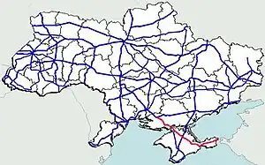
Highway M17 is a Ukrainian international highway (M-highway) connecting Kherson to the Russian border over the Kerch Strait, where it continues into Russia as the A290.[1] The M17 is part of European route E97.[2]
Since 2014 annexation of Crimea by Russia, a part of the road located on the peninsula is de facto operated by Russia, which designated that portion of the highway as two regional routes of the Republic of Crimea: 35A-001 north of the Krasnoperekopsk, and 35K-001 south of that town. The Tavrida Highway is partially concurrent with 35A-001.[3]
Main route
Main route and connections to/intersections with other highways in Ukraine.
| Marker | Main settlements | Notes | Highway Interchanges |
|---|---|---|---|
| 0 km | Kherson | ||
| Krasnoperekopsk | |||
| Dzhankoy | |||
| 423 km | Kerch |
Gallery
 Kerch Ferry Line
See also
References
- ↑ Ukraine International Highways in Russian
- ↑ European Highways in Russian
- ↑ List of regional and intermunicipal roads of the Republic of Crimea as designated by the Russian Council of Ministers of Crimea (in Russian)
External links
- International Roads in Ukraine in Russian
- European Roads in Russian
| E-roads in Ukraine | ||
|---|---|---|
| International | ||
| National | ||
| Regional | ||
| ||
This article is issued from Wikipedia. The text is licensed under Creative Commons - Attribution - Sharealike. Additional terms may apply for the media files.