Hongta
红塔区 | |
|---|---|
 | |
.png.webp) Location of Hongta District (pink) and Yuxi Prefecture (yellow) within Yunnan province of China | |
 Hongta Location within China  Hongta Hongta (China) | |
| Coordinates: 24°20′56″N 102°31′50″E / 24.34889°N 102.53056°E | |
| Country | China |
| Province | Yunnan |
| Prefecture-level city | Yuxi |
| District seat | Yuxing Subdistrict |
| Area | |
| • Total | 1,004 km2 (388 sq mi) |
| Population (2020 census)[1] | |
| • Total | 588,738 |
| • Density | 590/km2 (1,500/sq mi) |
| Postal code | 653100 |
| Area code | 0877 |
| Website | www |
| Yunnan e-Portal | |
Hongta District (simplified Chinese: 红塔区; traditional Chinese: 紅塔區; pinyin: Hóngtǎ Qū) is the main district of Yuxi, Yunnan Province, China.
Administrative divisions
The county government of Yuxi City is seated in Hongta District.
Hongta District has 9 subdistricts and 2 ethnic townships.[2]
- 9 subdistricts
|
|
- 2 ethnic townships
- Xiaoshiqiao Yi Ethnic Township (小石桥彝族乡)
- Luohe Yi Ethnic Township (洛河彝族乡)
Ethnic groups
The Yuxi City Almanac (1993:189) lists the following ethnic groups.
Transportation
Yuxi railway station is located here.
References
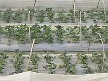
Strawberry fields in Hongta District
- ↑ "玉溪市第七次全国人口普查主要数据公报" (in Chinese). Government of Yuxi. 2021-05-28.
- ↑ "国家统计局" (in Chinese). National Bureau of Statistics of the People's Republic of China. Retrieved 2021-12-07.
- ↑ "红塔区洛河乡把者岱村民委员会梅冲村". Archived from the original on 2014-03-14. Retrieved 2014-03-14.
External links
This article is issued from Wikipedia. The text is licensed under Creative Commons - Attribution - Sharealike. Additional terms may apply for the media files.