Hotedršica | |
|---|---|
 | |
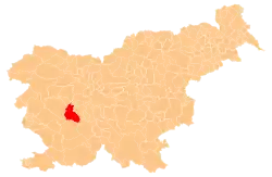
 Hotedršica Location in Slovenia | |
| Coordinates: 45°55′50.29″N 14°8′21.38″E / 45.9306361°N 14.1392722°E | |
| Country | |
| Traditional region | Inner Carniola |
| Statistical region | Central Slovenia |
| Municipality | Logatec |
| Area | |
| • Total | 3.99 km2 (1.54 sq mi) |
| Elevation | 544.9 m (1,787.7 ft) |
| Population (2002) | |
| • Total | 554 |
| [1] | |
Hotedršica (pronounced [xɔˈteːdəɾʃitsa], in older sources Hotedražica,[2] German: Hotederschitz[2]) is a village west of Logatec in the Inner Carniola region of Slovenia.[3]
Geography
Hotedršica includes the hamlets of Griče (in older sources: V Gričih, German: Am Hügel)[2] to the north, Koš to the east, and Čajna and Log to the south. Hotedršica lies in the middle of the Hotedršica Lowland (Slovene: Hotenjsko podolje), a low-lying area extending toward Kalce to the southeast and Godovič to the northwest with karst springs and sinkholes in the surrounding foothills.[4]
Name
Hotedršica was first attested in written sources in 1421 as Kathedresicz (and in 1496 as Kathedersicz). The name is a syncopated form of *Hotedražica, derived from the personal name *Xotědragъ (from *xotěti 'to desire' + *dorgъ 'good').[5][6]
Church
The parish church in the settlement is dedicated to John the Baptist and belongs to the Ljubljana Archdiocese.[7]
References
- ↑ Statistical Office of the Republic of Slovenia
- 1 2 3 Leksikon občin kraljestev in dežel zastopanih v državnem zboru, vol. 6: Kranjsko. Vienna: C. Kr. Dvorna in Državna Tiskarna. 1906. pp. 126–127.
- ↑ Logatec municipal site
- ↑ Habič, Peter (1992). "Ljubljanica". Enciklopedija Slovenije. Vol. 6. Ljubljana: Mladinska knjiga. p. 250.
- ↑ Snoj, Marko (2009). Etimološki slovar slovenskih zemljepisnih imen. Ljubljana: Modrijan. p. 162.
- ↑ Hotedršica Archived 2011-09-12 at the Wayback Machine (in Slovene)
- ↑ Družina RC Church in Slovenia Journal website
External links
 Media related to Hotedršica at Wikimedia Commons
- Hotedršica on Geopedia
| Settlements | Administrative seat: Logatec
|  | ||||
|---|---|---|---|---|---|---|
| Landmarks |
| |||||