Ilha das Flores | |
|---|---|
 Flag  Coat of arms | |
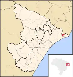 Location in Sergipe state | |
 Ilha das Flores Location in Brazil | |
| Coordinates: 10°26′9″S 36°32′13″W / 10.43583°S 36.53694°W | |
| Country | Brazil |
| Region | Northeast |
| State | Sergipe |
| Area | |
| • Total | 54.64 km2 (21.10 sq mi) |
| Population (2020 [1]) | |
| • Total | 8,521 |
| • Density | 160/km2 (400/sq mi) |
| Time zone | UTC−3 (BRT) |
Ilha das Flores is a municipality in the state of Sergipe (SE) in Brazil. The population is 8,521 (2020 est.) in an area of 54.64 km2 (21.10 sq mi).[2] The elevation is 3 m (9.8 ft).
References
- ↑ "IBGE 2020". Retrieved 26 January 2021.
- ↑ Instituto Brasileiro de Geografia e Estatística
Capital: Aracaju | |||||||||||||||
| Agreste Sergipano |
|  | |||||||||||||
| Leste Sergipano |
| ||||||||||||||
| Sertao Sergipano |
| ||||||||||||||
This article is issued from Wikipedia. The text is licensed under Creative Commons - Attribution - Sharealike. Additional terms may apply for the media files.