Itawa | |
|---|---|
Town | |
 Itawa  Itawa | |
| Coordinates: 25°32′24″N 76°22′45″E / 25.54000°N 76.37917°E | |
| Country | |
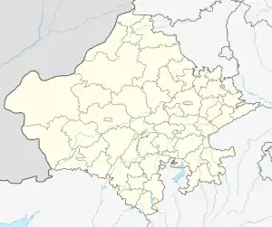
| State | Rajasthan |
| District | Kota |
| Tehsil | Pipalda |
| Area | |
| • Total | 2.91 km2 (1.12 sq mi) |
| Elevation | 225 m (738 ft) |
| Population (2011) | |
| • Total | 26,741 |
| • Density | 9,200/km2 (24,000/sq mi) |
| Time zone | UTC+5:30 (IST) |
| PIN | 325004 |
Itawa is a town in Pipalda Tehsil, Kota District, Rajasthan, India. It is located near the state boundary with Madhya Pradesh, about 79 kilometres northeast of the district seat Kota, and 5 kilometres southwest of the tehsil seat Pipalda. As of 2011, the town has a population of 26,741.[1]
Geography
Itawa is situated to the south of Fatehpura and Rajopa Villages, west of Khorawada Village, north of Gondi Village, and east of Dadwara Village. Rajasthan State Highway 1 passes through the west of the town. Its average elevation is at 225 metres above the sea level.[2]
Climate
Itawa has a Hot Semi-arid Climate. It receives the most abundant rainfall in July, with 264 mm of precipitation; and the most scarce rainfall in April, with 3 mm of precipitation.
| Climate data for Itawa | |||||||||||||
|---|---|---|---|---|---|---|---|---|---|---|---|---|---|
| Month | Jan | Feb | Mar | Apr | May | Jun | Jul | Aug | Sep | Oct | Nov | Dec | Year |
| Mean daily maximum °C (°F) | 23.4 (74.1) |
27.4 (81.3) |
33.4 (92.1) |
39.3 (102.7) |
42.2 (108.0) |
39.4 (102.9) |
32.9 (91.2) |
30.9 (87.6) |
32.6 (90.7) |
33.9 (93.0) |
29.8 (85.6) |
25.1 (77.2) |
32.5 (90.5) |
| Daily mean °C (°F) | 16.6 (61.9) |
20.2 (68.4) |
25.8 (78.4) |
31.7 (89.1) |
35.5 (95.9) |
34.2 (93.6) |
29.3 (84.7) |
27.7 (81.9) |
28.2 (82.8) |
27.3 (81.1) |
22.9 (73.2) |
18.1 (64.6) |
26.5 (79.6) |
| Mean daily minimum °C (°F) | 10 (50) |
13.1 (55.6) |
17.9 (64.2) |
23.4 (74.1) |
28.4 (83.1) |
29.3 (84.7) |
26.3 (79.3) |
25.1 (77.2) |
24.2 (75.6) |
20.8 (69.4) |
16.5 (61.7) |
11.7 (53.1) |
20.6 (69.0) |
| Average rainfall mm (inches) | 7 (0.3) |
7 (0.3) |
5 (0.2) |
3 (0.1) |
6 (0.2) |
79 (3.1) |
264 (10.4) |
243 (9.6) |
78 (3.1) |
13 (0.5) |
6 (0.2) |
7 (0.3) |
718 (28.3) |
| Source: Climate-Data.org[3] | |||||||||||||
Demographics
By 2011, Itawa hosts 5,257 households and 26,741 inhabitants. Out of the total population, 13,898 are male and 12,843 are female. The total literacy rate is 63.88%, with 10,273 of the male population and 6,808 of the female population being literate. The village's census location code is 101762.[1]
References
- 1 2 "Basic Population Figures of India, States, Districts, Sub-District and Village, 2011". censusindia.gov.in. Retrieved 7 April 2023.
- ↑ "Itawa topographic map, elevation, terrain". Topographic maps. Retrieved 7 April 2023.
- ↑ "Itawa climate: Temperature Itawa & Weather By Month - Climate-Data.org". en.climate-data.org. Retrieved 7 April 2023.