Laduani Airstrip | |||||||||||
|---|---|---|---|---|---|---|---|---|---|---|---|
 | |||||||||||
| Summary | |||||||||||
| Airport type | Public | ||||||||||
| Operator | Luchtvaartdienst Suriname | ||||||||||
| Serves | Aurora | ||||||||||
| Elevation AMSL | 236 ft / 72 m | ||||||||||
| Coordinates | 4°22′35″N 55°24′20″W / 4.37639°N 55.40556°W | ||||||||||
| Map | |||||||||||
 LDO Location in Suriname | |||||||||||
| Runways | |||||||||||
| |||||||||||
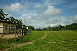
Laduani Airstrip (IATA: LDO, ICAO: SMDO), is an airport serving Aurora, Suriname.
Charters and destinations
Charter Airlines serving this airport are:
| Airlines | Destinations |
|---|---|
| Blue Wing Airlines | Charter: Paramaribo–Zorg en Hoop[3] |
| Gum Air | Charter: Paramaribo–Zorg en Hoop[4] |
| Hi-Jet Helicopter Services | Charter: Paramaribo–Zorg en Hoop |
See also
References
- ↑ Airport information for LDO at Great Circle Mapper.
- ↑ Google Maps - Laduani
- ↑ Blue Wing schedule Archived 2013-05-22 at the Wayback Machine
- ↑ Gum Air destinations
External links
This article is issued from Wikipedia. The text is licensed under Creative Commons - Attribution - Sharealike. Additional terms may apply for the media files.