| Lay | |
|---|---|
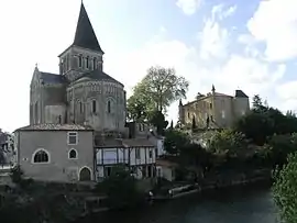 The Lay at Mareuil-sur-Lay-Dissais | |
.png.webp) | |
| Native name | Le Lay (French) |
| Location | |
| Country | France |
| Physical characteristics | |
| Source | |
| • location | Saint-Pierre-du-Chemin |
| • coordinates | 46°42′34″N 00°42′37″W / 46.70944°N 0.71028°W |
| • elevation | 195 m (640 ft) |
| Mouth | |
• location | Bay of Biscay |
• coordinates | 46°19′14″N 01°18′10″W / 46.32056°N 1.30278°W |
• elevation | 0 m (0 ft) |
| Length | 120 km (75 mi) |
| Basin size | 1,750 km2 (680 sq mi) |
| Discharge | |
| • average | 14 m3/s (490 cu ft/s) |
The Lay (French pronunciation: [lɛ]) is a 120-kilometre (75 mi) river in the Vendée département, western France.[1] Its source is at Saint-Pierre-du-Chemin and it flows generally southwest. It flows into the Bay of Biscay between La Faute-sur-Mer and L'Aiguillon-sur-Mer, 20 km (12 mi) northwest of La Rochelle.
Communes along its course
This list is ordered from source to mouth:
- Vendée: Saint-Pierre-du-Chemin, Menomblet, Réaumur, Montournais, La Meilleraie-Tillay, Pouzauges, Le Boupère, Monsireigne, Saint-Prouant, Sigournais, Bazoges-en-Pareds, Chantonnay, La Réorthe, Bournezeau, Sainte-Hermine, Sainte-Pexine, Moutiers-sur-le-Lay, Bessay, Mareuil-sur-Lay-Dissais, La Couture, Péault, La Bretonnière-la-Claye, Rosnay, Le Champ-Saint-Père, Saint-Vincent-sur-Graon, Saint-Cyr-en-Talmondais, Curzon, Lairoux, Saint-Benoist-sur-Mer, Grues, Angles, La Faute-sur-Mer, L'Aiguillon-sur-Mer,
References
Wikimedia Commons has media related to Lay.
This article is issued from Wikipedia. The text is licensed under Creative Commons - Attribution - Sharealike. Additional terms may apply for the media files.