Leuchtenberg | |
|---|---|
 Coat of arms | |
Location of Leuchtenberg within Neustadt a.d.Waldnaab district 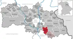 | |
 Leuchtenberg  Leuchtenberg | |
| Coordinates: 49°36′N 12°15′E / 49.600°N 12.250°E | |
| Country | Germany |
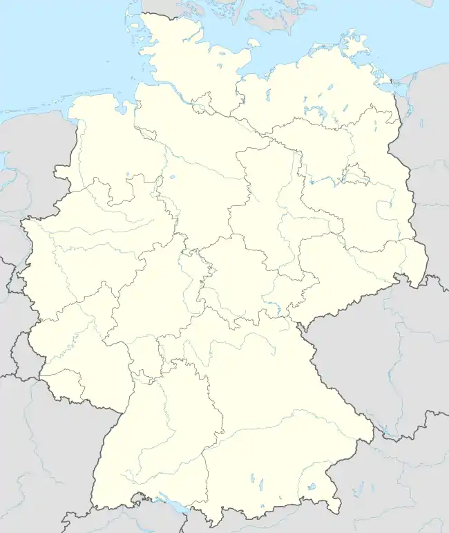
| State | Bavaria |
| Admin. region | Oberpfalz |
| District | Neustadt a.d.Waldnaab |
| Municipal assoc. | Tännesberg |
| Subdivisions | 18 Ortsteile |
| Government | |
| • Mayor (2020–26) | Anton Kappl[1] (CSU) |
| Area | |
| • Total | 32.37 km2 (12.50 sq mi) |
| Elevation | 572 m (1,877 ft) |
| Population (2022-12-31)[2] | |
| • Total | 1,133 |
| • Density | 35/km2 (91/sq mi) |
| Time zone | UTC+01:00 (CET) |
| • Summer (DST) | UTC+02:00 (CEST) |
| Postal codes | 92705 |
| Dialling codes | 09659 |
| Vehicle registration | NEW |
| Website | www.leuchtenberg.de |
Leuchtenberg is a municipality in the district of Neustadt an der Waldnaab in Bavaria, Germany, essentially a suburb of nearby Weiden in der Oberpfalz, and a larger historical region in the Holy Roman Empire governed by the Landgraves of Leuchtenberg.
Royal (noble) and notable (not noble) Leuchtenbergers
- Landgraves of Leuchtenberg
- Thomas Mohr, Wisconsin farmer and local official
See also
References
- ↑ Liste der ersten Bürgermeister/Oberbürgermeister in kreisangehörigen Gemeinden, Bayerisches Landesamt für Statistik, 15 July 2021.
- ↑ Genesis Online-Datenbank des Bayerischen Landesamtes für Statistik Tabelle 12411-003r Fortschreibung des Bevölkerungsstandes: Gemeinden, Stichtag (Einwohnerzahlen auf Grundlage des Zensus 2011)
| Ecclesiastical |  | |
|---|---|---|
| Secular | ||
Circles est. 1500: Bavarian, Swabian, Upper Rhenish, Lower Rhenish–Westphalian, Franconian, (Lower) Saxon Circles est. 1512: Austrian, Burgundian, Upper Saxon, Electoral Rhenish · Unencircled territories | ||
This article is issued from Wikipedia. The text is licensed under Creative Commons - Attribution - Sharealike. Additional terms may apply for the media files.