Lixing-lès-Rouhling | |
|---|---|
 The church in Lixing-lès-Rouhling | |
.svg.png.webp) Coat of arms | |
Location of Lixing-lès-Rouhling | |
 Lixing-lès-Rouhling 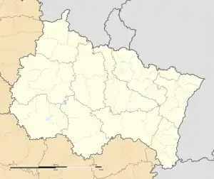 Lixing-lès-Rouhling | |
| Coordinates: 49°09′16″N 6°59′43″E / 49.1544°N 6.9953°E | |
| Country | France |
| Region | Grand Est |
| Department | Moselle |
| Arrondissement | Sarreguemines |
| Canton | Sarreguemines |
| Intercommunality | CA Sarreguemines Confluences |
| Government | |
| • Mayor (2020–2026) | Christiane Mallick [1] |
| Area 1 | 4.22 km2 (1.63 sq mi) |
| Population | 822 |
| • Density | 190/km2 (500/sq mi) |
| Time zone | UTC+01:00 (CET) |
| • Summer (DST) | UTC+02:00 (CEST) |
| INSEE/Postal code | 57408 /57520 |
| Elevation | 210–343 m (689–1,125 ft) |
| 1 French Land Register data, which excludes lakes, ponds, glaciers > 1 km2 (0.386 sq mi or 247 acres) and river estuaries. | |
Lixing-lès-Rouhling (French pronunciation: [liksɛ̃ lɛ ʁulɛ̃], literally Lixing near Rouhling; German: Lixingen) is a commune in the Moselle department in Grand Est in north-eastern France.
Population
| Year | Pop. | ±% p.a. |
|---|---|---|
| 1968 | 675 | — |
| 1975 | 734 | +1.20% |
| 1982 | 717 | −0.33% |
| 1990 | 789 | +1.20% |
| 1999 | 830 | +0.56% |
| 2007 | 896 | +0.96% |
| 2012 | 915 | +0.42% |
| 2017 | 937 | +0.48% |
| Source: INSEE[3] | ||
See also
References
- ↑ "Répertoire national des élus: les maires". data.gouv.fr, Plateforme ouverte des données publiques françaises (in French). 2 December 2020.
- ↑ "Populations légales 2021". The National Institute of Statistics and Economic Studies. 28 December 2023.
- ↑ Population en historique depuis 1968, INSEE
External links
 Media related to Lixing-lès-Rouhling at Wikimedia Commons
This article is issued from Wikipedia. The text is licensed under Creative Commons - Attribution - Sharealike. Additional terms may apply for the media files.