Mazirat | |
|---|---|
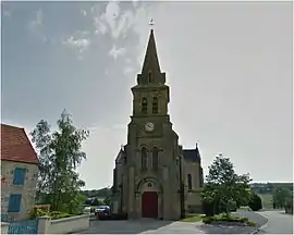 The church in Mazirat | |
 Coat of arms | |
Location of Mazirat | |
 Mazirat  Mazirat | |
| Coordinates: 46°13′25″N 2°32′26″E / 46.2236°N 2.5406°E | |
| Country | France |
| Region | Auvergne-Rhône-Alpes |
| Department | Allier |
| Arrondissement | Montluçon |
| Canton | Montluçon-3 |
| Intercommunality | CA Montluçon Communauté |
| Government | |
| • Mayor (2020–2026) | Magalie Jarraud[1] |
| Area 1 | 20.26 km2 (7.82 sq mi) |
| Population | 287 |
| • Density | 14/km2 (37/sq mi) |
| Time zone | UTC+01:00 (CET) |
| • Summer (DST) | UTC+02:00 (CEST) |
| INSEE/Postal code | 03167 /03420 |
| Elevation | 259–495 m (850–1,624 ft) (avg. 400 m or 1,300 ft) |
| 1 French Land Register data, which excludes lakes, ponds, glaciers > 1 km2 (0.386 sq mi or 247 acres) and river estuaries. | |
Mazirat (French pronunciation: [maziʁa]; Occitan: Mazeirac) is a commune in the Allier department in central France.[3]
Population
| Year | Pop. | ±% |
|---|---|---|
| 1962 | 350 | — |
| 1968 | 400 | +14.3% |
| 1975 | 320 | −20.0% |
| 1982 | 297 | −7.2% |
| 1990 | 301 | +1.3% |
| 1999 | 267 | −11.3% |
| 2008 | 289 | +8.2% |
| 2012 | 284 | −1.7% |
| Source: INSEE (1968–2012) | ||
See also
References
- ↑ "Répertoire national des élus: les maires" (in French). data.gouv.fr, Plateforme ouverte des données publiques françaises. 13 September 2022.
- ↑ "Populations légales 2021". The National Institute of Statistics and Economic Studies. 28 December 2023.
- ↑ INSEE commune file
Wikimedia Commons has media related to Mazirat.
This article is issued from Wikipedia. The text is licensed under Creative Commons - Attribution - Sharealike. Additional terms may apply for the media files.