Monroe County | |
|---|---|
 | |
 Location within the U.S. state of Georgia | |
 Georgia's location within the U.S. | |
| Coordinates: 33°01′N 83°55′W / 33.01°N 83.91°W | |
| Country | |
| State | |
| Founded | 1821 |
| Named for | James Monroe |
| Seat | Forsyth |
| Largest city | Forsyth |
| Government | |
| • Commission Chair | Greg Tapley |
| Area | |
| • Total | 398 sq mi (1,030 km2) |
| • Land | 396 sq mi (1,030 km2) |
| • Water | 2.2 sq mi (6 km2) 0.5% |
| Population (2020) | |
| • Total | 27,957 |
| • Density | 71/sq mi (27/km2) |
| Time zone | UTC−5 (Eastern) |
| • Summer (DST) | UTC−4 (EDT) |
| Congressional district | 8th |
| Website | www |
Monroe County is a county located in the central portion of the U.S. state of Georgia. As of the 2020 census, the population was 27,957.[1] The county seat is Forsyth.[2] The county was created on May 15, 1821.[3] The county was named for James Monroe.[4] Monroe County is included in the Macon, GA metropolitan statistical area.
Geography
According to the U.S. Census Bureau, the county has a total area of 398 square miles (1,030 km2), of which 396 square miles (1,030 km2) is land and 2.2 square miles (5.7 km2) (0.5%) is water.[5] It is located in the Piedmont region of the state.
The vast majority of Monroe County is located in the Upper Ocmulgee River sub-basin of the Altamaha River basin, with just a tiny southwestern corner of the county, west of a line between Yatesville and Culloden, located in the Upper Flint River sub-basin of the ACF River Basin (Apalachicola-Chattahoochee-Flint River Basin).[6]
Major highways
 Interstate 75
 Interstate 475
 U.S. Route 23
 U.S. Route 41
 U.S. Route 341
 State Route 7
 State Route 18
 State Route 19
 State Route 42
 State Route 74
 State Route 83
 State Route 87
 State Route 401 (unsigned designation for I-75)
 State Route 408 (unsigned designation for I-475)
Adjacent counties
- Butts County (north)
- Jasper County (northeast)
- Jones County (east)
- Bibb County (southeast)
- Crawford County (south)
- Upson County (southwest)
- Lamar County (west)
Communities
Cities
Census-designated places
Unincorporated communities
Demographics
| Census | Pop. | Note | %± |
|---|---|---|---|
| 1830 | 16,202 | — | |
| 1840 | 16,275 | 0.5% | |
| 1850 | 16,985 | 4.4% | |
| 1860 | 15,953 | −6.1% | |
| 1870 | 17,213 | 7.9% | |
| 1880 | 18,808 | 9.3% | |
| 1890 | 19,137 | 1.7% | |
| 1900 | 20,682 | 8.1% | |
| 1910 | 20,450 | −1.1% | |
| 1920 | 20,138 | −1.5% | |
| 1930 | 11,606 | −42.4% | |
| 1940 | 10,749 | −7.4% | |
| 1950 | 10,523 | −2.1% | |
| 1960 | 10,495 | −0.3% | |
| 1970 | 10,991 | 4.7% | |
| 1980 | 14,610 | 32.9% | |
| 1990 | 17,113 | 17.1% | |
| 2000 | 21,757 | 27.1% | |
| 2010 | 26,424 | 21.5% | |
| 2020 | 27,957 | 5.8% | |
| U.S. Decennial Census[7] 1790-1880[8]1890-1910[9] 1920-1930[10] 1930-1940[11] 1940-1950[12] 1960-1980[13] 1980-2000[14] 2010[15] 2020[16] | |||
2020 census
| Race / Ethnicity | Pop 2000[17] | Pop 2010[15] | Pop 2020[16] | % 2000 | % 2010 | % 2020 |
|---|---|---|---|---|---|---|
| White alone (NH) | 15,150 | 19,101 | 19,954 | 69.63% | 72.29% | 71.37% |
| Black or African American alone (NH) | 6,015 | 6,249 | 6,084 | 27.65% | 23.65% | 21.76% |
| Native American or Alaska Native alone (NH) | 67 | 64 | 34 | 0.31% | 0.24% | 0.12% |
| Asian alone (NH) | 74 | 209 | 239 | 0.34% | 0.79% | 0.85% |
| Pacific Islander alone (NH) | 6 | 4 | 0 | 0.03% | 0.02% | 0.00% |
| Some Other Race alone (NH) | 6 | 14 | 86 | 0.03% | 0.05% | 0.31% |
| Mixed Race/Multi-Racial (NH) | 158 | 248 | 846 | 0.73% | 0.94% | 3.03% |
| Hispanic or Latino (any race) | 281 | 535 | 714 | 1.29% | 2.02% | 2.55% |
| Total | 21,757 | 26,424 | 27,957 | 100.00% | 100.00% | 100.00% |
As of the 2020 United States census, there were 27,957 people, 9,760 households, and 6,179 families residing in the county.
Politics
| Year | Republican | Democratic | Third party | |||
|---|---|---|---|---|---|---|
| No. | % | No. | % | No. | % | |
| 2020 | 11,057 | 70.91% | 4,385 | 28.12% | 150 | 0.96% |
| 2016 | 8,832 | 69.61% | 3,571 | 28.15% | 284 | 2.24% |
| 2012 | 8,361 | 68.00% | 3,785 | 30.78% | 149 | 1.21% |
| 2008 | 7,933 | 65.31% | 4,106 | 33.80% | 108 | 0.89% |
| 2004 | 6,522 | 66.59% | 3,216 | 32.84% | 56 | 0.57% |
| 2000 | 4,561 | 60.48% | 2,839 | 37.65% | 141 | 1.87% |
| 1996 | 3,054 | 48.19% | 2,768 | 43.67% | 516 | 8.14% |
| 1992 | 2,423 | 39.28% | 2,774 | 44.97% | 971 | 15.74% |
| 1988 | 2,570 | 56.38% | 1,970 | 43.22% | 18 | 0.39% |
| 1984 | 2,420 | 52.51% | 2,189 | 47.49% | 0 | 0.00% |
| 1980 | 1,242 | 32.18% | 2,542 | 65.85% | 76 | 1.97% |
| 1976 | 1,078 | 26.68% | 2,962 | 73.32% | 0 | 0.00% |
| 1972 | 2,181 | 73.43% | 789 | 26.57% | 0 | 0.00% |
| 1968 | 770 | 23.91% | 1,028 | 31.93% | 1,422 | 44.16% |
| 1964 | 1,665 | 51.33% | 1,578 | 48.64% | 1 | 0.03% |
| 1960 | 581 | 26.14% | 1,642 | 73.86% | 0 | 0.00% |
| 1956 | 506 | 24.67% | 1,545 | 75.33% | 0 | 0.00% |
| 1952 | 501 | 17.23% | 2,406 | 82.77% | 0 | 0.00% |
| 1948 | 169 | 11.90% | 881 | 62.04% | 370 | 26.06% |
| 1944 | 410 | 26.59% | 1,132 | 73.41% | 0 | 0.00% |
| 1940 | 49 | 4.58% | 1,014 | 94.86% | 6 | 0.56% |
| 1936 | 147 | 10.27% | 1,277 | 89.24% | 7 | 0.49% |
| 1932 | 45 | 3.61% | 1,200 | 96.31% | 1 | 0.08% |
| 1928 | 329 | 29.12% | 801 | 70.88% | 0 | 0.00% |
| 1924 | 64 | 8.34% | 672 | 87.61% | 31 | 4.04% |
| 1920 | 83 | 9.02% | 837 | 90.98% | 0 | 0.00% |
| 1916 | 65 | 7.76% | 721 | 86.04% | 52 | 6.21% |
| 1912 | 50 | 6.49% | 702 | 91.17% | 18 | 2.34% |
Education
All parts of the county are in the Monroe County School District.[19]
See also
References
- ↑ "Census - Geography Profile: Monroe County, Georgia". United States Census Bureau. Retrieved December 27, 2022.
- ↑ "Find a County". National Association of Counties. Retrieved June 7, 2011.
- ↑ Krakow, Kenneth K. (1975). Georgia Place-Names: Their History and Origins (PDF). Macon, GA: Winship Press. p. 150. ISBN 0-915430-00-2. Archived (PDF) from the original on July 18, 2003.
- ↑ Gannett, Henry (1905). The Origin of Certain Place Names in the United States. U.S. Government Printing Office. p. 212.
- ↑ "US Gazetteer files: 2010, 2000, and 1990". United States Census Bureau. February 12, 2011. Retrieved April 23, 2011.
- ↑ "Georgia Soil and Water Conservation Commission Interactive Mapping Experience". Georgia Soil and Water Conservation Commission. Retrieved November 20, 2015.
- ↑ "Decennial Census of Population and Housing by Decades". US Census Bureau.
- ↑ "1880 Census Population by Counties 1790-1800" (PDF). US Census Bureau. 1880.
- ↑ "1910 Census of Population - Georgia" (PDF). US Census Bureau. 1910.
- ↑ "1930 Census of Population - Georgia" (PDF). US Census Bureau. 1930.
- ↑ "1940 Census of Population - Georgia" (PDF). US Census Bureau. 1940.
- ↑ "1950 Census of Population - Georgia -" (PDF). US Census Bureau. 1950.
- ↑ "1980 Census of Population - Number of Inhabitants - Georgia" (PDF). US Census Bureau. 1980.
- ↑ "2000 Census of Population - Population and Housing Unit Counts - Georgia" (PDF). US Census Bureau. 2000.
- 1 2 "P2 HISPANIC OR LATINO, AND NOT HISPANIC OR LATINO BY RACE – 2010: DEC Redistricting Data (PL 94-171) – Monroe County, Georgia". United States Census Bureau.
- 1 2 "P2 HISPANIC OR LATINO, AND NOT HISPANIC OR LATINO BY RACE – 2020: DEC Redistricting Data (PL 94-171) – Monroe County, Georgia". United States Census Bureau.
- ↑ "P004 HISPANIC OR LATINO, AND NOT HISPANIC OR LATINO BY RACE – 2000: DEC Summary File 1 – Monroe County, Georgia". United States Census Bureau.
- ↑ Leip, David. "Dave Leip's Atlas of U.S. Presidential Elections". uselectionatlas.org. Retrieved March 22, 2018.
- ↑ "2020 CENSUS - SCHOOL DISTRICT REFERENCE MAP: Monroe County, GA" (PDF). U.S. Census Bureau. Retrieved August 1, 2022. - Text list
Places adjacent to Monroe County, Georgia | ||||||||||||||||
|---|---|---|---|---|---|---|---|---|---|---|---|---|---|---|---|---|
| ||||||||||||||||
Municipalities and communities of Monroe County, Georgia, United States | ||
|---|---|---|
| Cities | Map of Georgia highlighting Monroe County | |
| CDPs | ||
| Other unincorporated communities | ||
| Ghost town | ||
| Principal cities | 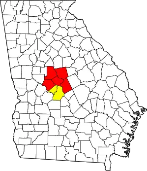 | |
|---|---|---|
| Municipalities | ||
| Other communities | ||
| Counties | ||
| CSA components | ||