| Mont-Fallère | |
|---|---|
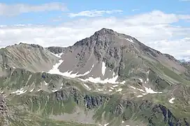 West face of the Mont Fallère | |
| Highest point | |
| Elevation | 3,061 m (10,043 ft)[1] |
| Prominence | 554 m (1,818 ft)[2] |
| Isolation | 10.26 km (6.38 mi) |
| Listing | Alpine mountains above 3000 m |
| Coordinates | 45°46′32″N 7°11′42″E / 45.7755°N 7.1950°E |
| Geography | |
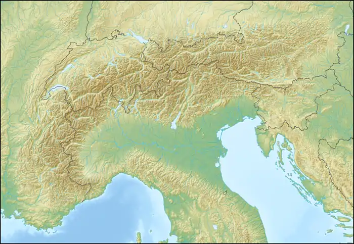 Mont-Fallère Location in the Alps | |
| Location | Aosta Valley, Italy |
| Parent range | Pennine Alps |
| Climbing | |
| Easiest route | Hike |
The Mont-Fallère or Mont Fallère[1] (sometimes wrongly spelled in Italian as Fallere) is a 3,061.5[1] metres high mountain belonging to the Italian side of Pennine Alps.
Geography
The Mont-Fallère is located on the ridge dividing the Great St Bernard Valley (North and East)[3] from the Valdigne, a term and used to define the upper part of the Aosta Valley. Administratively the mountain is the tripoint connecting the Italian comunes of Sarre, Gignod and Saint-Pierre.
SOIUSA classification
According to SOIUSA (International Standardized Mountain Subdivision of the Alps) the mountain can be classified in the following way:[4]
- main part = Western Alps
- major sector = North Western Alps
- section = Pennine Alps
- subsection = Grand Combin Alps
- supergroup = Catena Grande Rochère-Grand Golliaz
- group = Grande Rochère-Monte Fallère
- subgroup = Gruppo del Monte Fallère
- code = I/B-9.I-A.2.b
Access to the summit
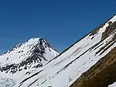
The mountain can be accessed by signposted routes or from Thouraz (1.652 m), a village in the comune of Sarre, or from Vétan (Saint-Pierre).[5] Both of them require some hiking experience. The top of Mont-Fallère offers a good point of view on Mont Blanc, Grand Combin, Grivola[6] and many other peaks of the Graian and Pennine Alps.
Mountain huts
- Refuge du Mont-Fallère (2,385 m).
Maps
- Military Geographic Institute (IGM) official maps of Italy, 1:25.000 and 1:100.000 scale, on-line version
- Carta dei sentieri e dei rifugi scala 1:50.000 n. 5 Cervino e Monte Rosa, Istituto Geografico Centrale - Torino
External links
- "Tour du Mont Fallère on lovevda.org".
- "Access route on camptocamp.org" (in French).
- "Access route on vienormali.it" (in Italian).
References
- 1 2 3 "Navigatore Cartografico SCT (3.14.0)". geonavsct.partout.it. Regione Autonoma Valle d'Aosta. Retrieved 2018-12-17.
- ↑ "Monte Fallere, Italy". Peakbagger.com. Retrieved 2018-12-18.
- ↑ "Navigatore Cartografico SCT (3.14.0)". geonavsct.partout.it. Regione Autonoma Valle d'Aosta. Retrieved 2018-11-26.
- ↑ Marazzi, Sergio (2005). Atlante Orografico delle Alpi. SOIUSA (in Italian). Priuli & Verlucca. ISBN 978-88-8068-273-8.
- ↑ "Fallère (Mont) da Vetan, anello - Valle d'Aosta". gulliver.it (in Italian). Retrieved 2018-12-17.
- ↑ "Bollettino" (in Italian). 13. Club Alpino Italiano. 1879: 388–389.
{{cite journal}}: Cite journal requires|journal=(help)