Montbré | |
|---|---|
 | |
Location of Montbré | |
 Montbré 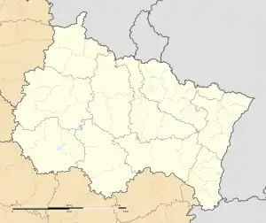 Montbré | |
| Coordinates: 49°11′37″N 4°02′32″E / 49.1936°N 4.0422°E | |
| Country | France |
| Region | Grand Est |
| Department | Marne |
| Arrondissement | Reims |
| Canton | Mourmelon-Vesle et Monts de Champagne |
| Intercommunality | CU Grand Reims |
| Government | |
| • Mayor (2020–2026) | Maryse Lequeux[1] |
| Area 1 | 3.08 km2 (1.19 sq mi) |
| Population | 367 |
| • Density | 120/km2 (310/sq mi) |
| Time zone | UTC+01:00 (CET) |
| • Summer (DST) | UTC+02:00 (CEST) |
| INSEE/Postal code | 51375 /51500 |
| Elevation | 103–165 m (338–541 ft) |
| 1 French Land Register data, which excludes lakes, ponds, glaciers > 1 km2 (0.386 sq mi or 247 acres) and river estuaries. | |
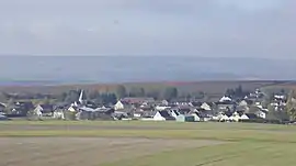
Montbré (French pronunciation: [mɔ̃bʁe]) is a commune in the Marne department in north-eastern France.[3] The area of the commune of Montbré is 3.08 km2, and its elevation range lies between 103 and 165 m.[4]
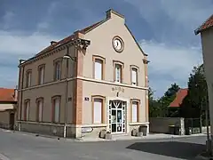 The town hall in Montbré
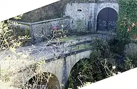 Serré-de-Rivière, fortification
See also
References
- ↑ "Répertoire national des élus: les maires" (in French). data.gouv.fr, Plateforme ouverte des données publiques françaises. 13 September 2022.
- ↑ "Populations légales 2021". The National Institute of Statistics and Economic Studies. 28 December 2023.
- ↑ Commune de Montbré (51375), INSEE
- ↑ Des villages de Cassini aux communes d'aujourd'hui: Commune data sheet Montbré, EHESS (in French).
Wikimedia Commons has media related to Montbré.
This article is issued from Wikipedia. The text is licensed under Creative Commons - Attribution - Sharealike. Additional terms may apply for the media files.