Montgardin | |
|---|---|
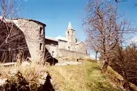 A view of the church in the village of Montgardin | |
 Coat of arms | |
Location of Montgardin | |
 Montgardin  Montgardin | |
| Coordinates: 44°33′04″N 6°14′25″E / 44.5511°N 6.2403°E | |
| Country | France |
| Region | Provence-Alpes-Côte d'Azur |
| Department | Hautes-Alpes |
| Arrondissement | Gap |
| Canton | Chorges |
| Government | |
| • Mayor (2021–2026) | Christian Borel[1] |
| Area 1 | 15.32 km2 (5.92 sq mi) |
| Population | 478 |
| • Density | 31/km2 (81/sq mi) |
| Time zone | UTC+01:00 (CET) |
| • Summer (DST) | UTC+02:00 (CEST) |
| INSEE/Postal code | 05084 /05230 |
| Elevation | 772–1,420 m (2,533–4,659 ft) (avg. 839 m or 2,753 ft) |
| 1 French Land Register data, which excludes lakes, ponds, glaciers > 1 km2 (0.386 sq mi or 247 acres) and river estuaries. | |
Montgardin (French pronunciation: [mɔ̃ɡaʁdɛ̃]) is a commune in the Hautes-Alpes department in southeastern France.
Population
| Year | Pop. | ±% p.a. |
|---|---|---|
| 1968 | 182 | — |
| 1975 | 176 | −0.48% |
| 1982 | 249 | +5.08% |
| 1990 | 304 | +2.53% |
| 1999 | 380 | +2.51% |
| 2009 | 454 | +1.80% |
| 2014 | 461 | +0.31% |
| 2020 | 465 | +0.14% |
| Source: INSEE[3] | ||
See also
References
- ↑ "Répertoire national des élus: les maires" (in French). data.gouv.fr, Plateforme ouverte des données publiques françaises. 4 May 2022.
- ↑ "Populations légales 2021". The National Institute of Statistics and Economic Studies. 28 December 2023.
- ↑ Population en historique depuis 1968, INSEE
Wikimedia Commons has media related to Montgardin.
This article is issued from Wikipedia. The text is licensed under Creative Commons - Attribution - Sharealike. Additional terms may apply for the media files.