Nayong County
纳雍县 | |
|---|---|
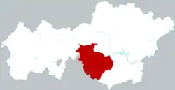 Nayong in Bijie | |
.png.webp) Bijie in Guizhou | |
| Coordinates (Nayong County government): 26°46′45″N 105°24′53″E / 26.7793°N 105.4146°E | |
| Country | People's Republic of China |
| Province | Guizhou |
| Prefecture-level city | Bijie |
| Area | |
| • Total | 2,452.32 km2 (946.85 sq mi) |
| Population (2016)[1] | |
| • Total | 1,081,429 |
| • Density | 440/km2 (1,100/sq mi) |
| Time zone | UTC+8 (China Standard) |
Nayong County (simplified Chinese: 纳雍县; traditional Chinese: 納雍縣; pinyin: Nàyōng Xiàn) is a county in the west of Guizhou province, China. It is under the administration of Bijie city. It is rich in natural resources: coal, lead, zinc, marble, sulfur, iron, fluorite, dolomite, limestone and others. A significant portion of Guizhou's coal production is extracted in Nayong.[1] Nayong's marble is famous in China, and the annual production is 1,400,000 cubic metres (49,000,000 cu ft).[2] For agriculture, timber, tobacco, walnut and tea are some products of importance. In 2016, the total GDP was RMB 18,900,000,000, with a GDP per capita of RMB 27,843.
Administrative divisions
Nayong is partitioned in the following town-level divisions:[3]
- Yongxi subdistrict (雍熙街道)
- Wenchang subdistrict (文昌街道)
- Juren subdistrict (居仁街道)
- Zonglin town (骔岭镇)
- Shaowo town (勺窝镇)
- Yangchang town (阳长镇)
- Xinfang township (新房乡)
- Weixin town (维新镇)
- Dongdi township (董地乡)
- Shedongguan township (厍东关乡)
- Longchang town (龙场镇)
- Zhaile town (寨乐镇)
- Huazuo township (化作乡)
- Lezhi town (乐治镇)
- Yulongba town (玉龙坝镇)
- Shabao town (沙包镇)
- Shuidong town (东镇)
- Baixing town (百兴镇)
- Shuguang town (曙光镇)
- Gukai township (姑开乡)
- Guoquanyan township (锅圈岩乡)
- Yangchang township (羊场乡)
- Kunzhai township (昆寨乡)
- Zhuchang Miao and Yi Ethnic township (猪场苗族彝族乡)
- Zuojiujia township (左鸠戛乡)
- Zhangjiawan town (张家湾镇)
Climate
| Climate data for Nayong (1991–2020 normals, extremes 1981–2010) | |||||||||||||
|---|---|---|---|---|---|---|---|---|---|---|---|---|---|
| Month | Jan | Feb | Mar | Apr | May | Jun | Jul | Aug | Sep | Oct | Nov | Dec | Year |
| Record high °C (°F) | 23.5 (74.3) |
30.1 (86.2) |
34.1 (93.4) |
33.4 (92.1) |
33.9 (93.0) |
33.2 (91.8) |
33.0 (91.4) |
32.6 (90.7) |
32.9 (91.2) |
28.9 (84.0) |
26.9 (80.4) |
22.1 (71.8) |
34.1 (93.4) |
| Mean daily maximum °C (°F) | 7.7 (45.9) |
11.1 (52.0) |
15.9 (60.6) |
20.9 (69.6) |
23.4 (74.1) |
24.9 (76.8) |
27.0 (80.6) |
26.9 (80.4) |
23.8 (74.8) |
18.7 (65.7) |
15.2 (59.4) |
9.6 (49.3) |
18.8 (65.8) |
| Daily mean °C (°F) | 3.9 (39.0) |
6.4 (43.5) |
10.5 (50.9) |
15.2 (59.4) |
18.3 (64.9) |
20.4 (68.7) |
22.1 (71.8) |
21.5 (70.7) |
18.8 (65.8) |
14.6 (58.3) |
10.6 (51.1) |
5.6 (42.1) |
14.0 (57.2) |
| Mean daily minimum °C (°F) | 1.6 (34.9) |
3.5 (38.3) |
7.0 (44.6) |
11.4 (52.5) |
14.5 (58.1) |
17.3 (63.1) |
18.8 (65.8) |
18.0 (64.4) |
15.6 (60.1) |
12.1 (53.8) |
7.7 (45.9) |
3.2 (37.8) |
10.9 (51.6) |
| Record low °C (°F) | −7.6 (18.3) |
−4.8 (23.4) |
−4.3 (24.3) |
0.6 (33.1) |
4.8 (40.6) |
9.4 (48.9) |
9.3 (48.7) |
10.8 (51.4) |
6.2 (43.2) |
2.4 (36.3) |
−3.3 (26.1) |
−7.5 (18.5) |
−7.6 (18.3) |
| Average precipitation mm (inches) | 29.8 (1.17) |
21.1 (0.83) |
36.2 (1.43) |
67.2 (2.65) |
139.4 (5.49) |
229.6 (9.04) |
223.3 (8.79) |
154.4 (6.08) |
140.3 (5.52) |
101.3 (3.99) |
34.1 (1.34) |
23.5 (0.93) |
1,200.2 (47.26) |
| Average precipitation days (≥ 0.1 mm) | 20.1 | 17.1 | 16.8 | 17.3 | 18.0 | 19.6 | 16.7 | 15.8 | 14.3 | 19.1 | 14.5 | 17.5 | 206.8 |
| Average snowy days | 5.3 | 3.4 | 0.5 | 0 | 0 | 0 | 0 | 0 | 0 | 0 | 0.3 | 2.2 | 11.7 |
| Average relative humidity (%) | 86 | 82 | 78 | 76 | 76 | 81 | 80 | 80 | 81 | 85 | 83 | 85 | 81 |
| Mean monthly sunshine hours | 56.8 | 75.5 | 108.5 | 134.3 | 132.6 | 105.8 | 158.3 | 167.3 | 128.6 | 78.1 | 90.3 | 63.1 | 1,299.2 |
| Percent possible sunshine | 17 | 24 | 29 | 35 | 32 | 26 | 38 | 42 | 35 | 22 | 28 | 19 | 29 |
| Source: China Meteorological Administration[4][5] | |||||||||||||
Demographics
The total population is a little over 1 million people as of 2016 with a male to female ratio of 1.07:1. The urban population was 242,379 people. Nayong is home to at least 29 ethnic minorities such as Miao, Yi, Bai, Buyi, Hui, Dong and Zhuang.[1]
Transportation
Nayong has a railway station on the Zhijin to Liupanshui railroad, which was completed in 2015.[6]
References
- 1 2 3 4 "珙桐纳雍_纳雍县人民政府". Archived from the original on 2018-02-13. Retrieved 2018-02-12.
- ↑ "纳雍大理石_纳雍县人民政府". www.gznayong.gov.cn. Archived from the original on 2018-02-13.
- ↑ "政府机构设置介绍_政务公开_纳雍县人民政府". www.gznayong.gov.cn. Archived from the original on 2018-02-13.
- ↑ 中国气象数据网 – WeatherBk Data (in Simplified Chinese). China Meteorological Administration. Retrieved 28 April 2023.
- ↑ 中国气象数据网 (in Simplified Chinese). China Meteorological Administration. Retrieved 28 April 2023.
- ↑ "提示信息".