| Nekite River | |
|---|---|
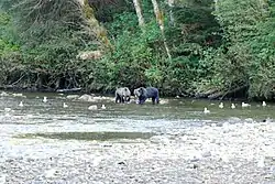 Grizzly bears on the Nekite River | |
 Mouth of Nekite River | |
| Location | |
| Country | Canada |
| Province | British Columbia |
| District | Range 2 Coast Land District |
| Physical characteristics | |
| Source | Coast Mountains |
| Mouth | Smith Inlet |
• location | Smith Sound |
• coordinates | 51°23′12″N 127°6′54″W / 51.38667°N 127.11500°W[1] |
• elevation | 0 m (0 ft)[2] |
The Nekite River is a river in the Central Coast region of British Columbia, Canada, flowing south to the head of Smith Inlet.[1] Nekite Indian Reserve No. 2 is located at the mouth of the river and is one of the many reserves of the Gwa'sala-'Nakwaxda'xw Nations band government located in the area of Smith Sound, of which Smith Inlet is the uppermost part.[3]
The Piper River is a tributary of the Nekite, flowing west to meet it at 51°25′34″N 127°04′57″W / 51.42611°N 127.08250°W.[4] Piper Lake is an expansion of the Piper River, located a short distance above the confluence at 51°25′15″N 127°01′37″W / 51.42083°N 127.02694°W.[5]
See also
References
- 1 2 "Nekite River". BC Geographical Names.
- ↑ Elevation derived from ASTER Global Digital Elevation Model, using GeoLocator, BCGNIS coordinates, and topographic maps.
- ↑ BC Names/GeoBC entry "Nekite 2 (Indian reserve)"
- ↑ BC Names/GeoBC entry "Piper River"
- ↑ BC Names/GeoBC entry "Piper Lake"
Wikimedia Commons has media related to Nekite River.
This article is issued from Wikipedia. The text is licensed under Creative Commons - Attribution - Sharealike. Additional terms may apply for the media files.