Nordwalde | |
|---|---|
 Elementary School in Nordwalde | |
 Coat of arms | |
Location of Nordwalde within Steinfurt district  | |
 Nordwalde  Nordwalde | |
| Coordinates: 52°05′N 7°29′E / 52.083°N 7.483°E | |
| Country | Germany |
| State | North Rhine-Westphalia |
| Admin. region | Münster |
| District | Steinfurt |
| Subdivisions | 6 |
| Government | |
| • Mayor (2020–25) | Sonja Schemmann[1] (CDU) |
| Area | |
| • Total | 51.6 km2 (19.9 sq mi) |
| Elevation | 55 m (180 ft) |
| Population (2021-12-31)[2] | |
| • Total | 9,711 |
| • Density | 190/km2 (490/sq mi) |
| Time zone | UTC+01:00 (CET) |
| • Summer (DST) | UTC+02:00 (CEST) |
| Postal codes | 48356 |
| Dialling codes | 02573 |
| Vehicle registration | ST, BF, TE |
| Website | www.nordwalde.de |
Nordwalde (literally: north woods) is a municipality in the district of Steinfurt, in North Rhine-Westphalia, Germany.
Geography
It is situated in the Münsterland area, approximately 12 km south-east of Steinfurt and 20 km north-west of Münster. The distance to the Dutch border is about 30 km.
Neighbouring municipalities
Division of the town
Nordwalde consists of 6 districts:
- Nordwalde
- Feldbauerschaft
- Kirchbauerschaft
- Scheddebrock
- Suttorf
- Westerode
Twin towns
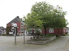
The Amilly Square in the centre of Nordwalde
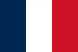 Amilly, France
 Treuenbrietzen, Germany
References
- ↑ Wahlergebnisse in NRW Kommunalwahlen 2020, Land Nordrhein-Westfalen, accessed 30 June 2021.
- ↑ "Bevölkerung der Gemeinden Nordrhein-Westfalens am 31. Dezember 2021" (in German). Landesbetrieb Information und Technik NRW. Retrieved 20 June 2022.
External links
- Official website
 (in German)
Towns and municipalities in Steinfurt (district) | ||
|---|---|---|
Coat of Arms of Steinfurt district | ||
This article is issued from Wikipedia. The text is licensed under Creative Commons - Attribution - Sharealike. Additional terms may apply for the media files.