Orešany | |
|---|---|
Municipality | |
 Church of the Exaltation of the Holy Cross | |
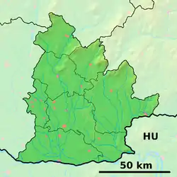 Orešany Location of Orešany in the Nitra Region 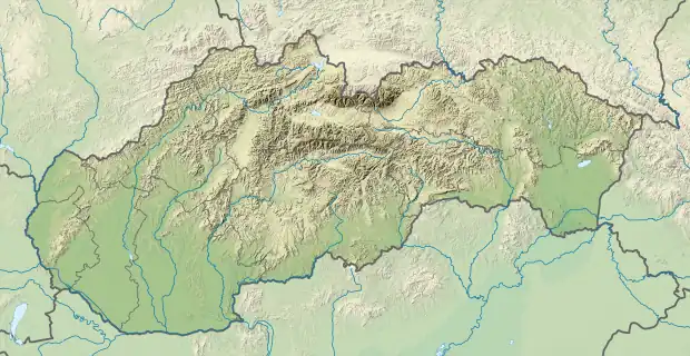 Orešany Location of Orešany in Slovakia | |
| Coordinates: 48°30′40″N 17°54′00″E / 48.51111°N 17.90000°E | |
| Country | |
| Region | Nitra |
| District | Topoľčany |
| First mentioned | 1330 |
| Area | |
| • Total | 6.71[1] km2 (2.59[1] sq mi) |
| Elevation | 238[2] m (781[2] ft) |
| Population (2021) | |
| • Total | 322[3] |
| Time zone | UTC+1 (CET) |
| • Summer (DST) | UTC+2 (CEST) |
| Postal code | 956 06[2] |
| Area code | +421 38[2] |
| Car plate | TO |
| Website | www |
Orešany (Hungarian: Tótdiós) is a municipality in the Topoľčany District of the Nitra Region, Slovakia.[4] In 2011 it had 325 inhabitants.[5]
References
- 1 2 "Hustota obyvateľstva - obce [om7014rr_ukaz: Rozloha (Štvorcový meter)]". www.statistics.sk (in Slovak). Statistical Office of the Slovak Republic. 2022-03-31. Retrieved 2022-03-31.
- 1 2 3 4 "Základná charakteristika". www.statistics.sk (in Slovak). Statistical Office of the Slovak Republic. 2015-04-17. Retrieved 2022-03-31.
- ↑ "Počet obyvateľov podľa pohlavia - obce (ročne)". www.statistics.sk (in Slovak). Statistical Office of the Slovak Republic. 2022-03-31. Retrieved 2022-03-31.
- ↑ "E-OBCE.sk - Information about Slovak Villages, Towns and Cities (SLOVAKIA)". Archived from the original on March 22, 2014. Retrieved March 22, 2014.
- ↑ "Archived copy" (PDF). Archived from the original (PDF) on October 12, 2013. Retrieved August 9, 2012.
{{cite web}}: CS1 maint: archived copy as title (link)
External links
 Media related to Orešany at Wikimedia Commons
- Official website

- https://web.archive.org/web/20140322134514/http://en.e-obce.sk/obec/oresany/oresany.html
This article is issued from Wikipedia. The text is licensed under Creative Commons - Attribution - Sharealike. Additional terms may apply for the media files.