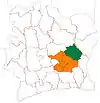
Ouellé, Ivory Coast
Ouellé Koumanou | |
|---|---|
Town, sub-prefecture, and commune | |
| Ouellé | |
 Ouellé, Ivory Coast Location in Ivory Coast | |
| Coordinates: 7°18′N 4°1′W / 7.300°N 4.017°W | |
| Country | Ivory Coast |
| District | Lacs |
| Region | Iffou |
| Department | Ouellé |
| Population (2014)[1] | |
| • Total | 27,521 |
| Time zone | UTC+0 (GMT) |
Ouellé is a town in east-central Ivory Coast. It is a sub-prefecture and commune of Ouellé Department in Iffou Region, Lacs District.
In 2014, the population of the sub-prefecture of Ouellé was 27,521.[2]
Villages
The 21 villages of the sub-prefecture of Ouellé and their population in 2014 are:[2]
- Balékokro (1 194)
- Dagou-N'gattakro (366)
- Kodi (1 932)
- Kodiakro (890)
- Koumélékro (1 208)
- Krindjabo (1 011)
- N'zi-Akakro (753)
- Ouellé (6 543)
- Ouellé-Koumanou (1 435)
- Sika-Komenankro (802)
- Abouadoukpinkro (1 077)
- Adiaou (756)
- Assalékro (302)
- Bendiè-Komenankro (1 955)
- Daoulébo (968)
- Ebini-Kouadiokro (705)
- Egoukro (736)
- Kouakoussékro (1 675)
- Koviessou (296)
- Panigokro (981)
- Prikro-Ouellé (1 936)
References
- ↑ "Côte d'Ivoire". geohive.com. Retrieved 9 December 2015.
- 1 2 "RGPH 2014, Répertoire des localités, Région Iffou" (PDF). ins.ci. Retrieved 5 August 2019.
This article is issued from Wikipedia. The text is licensed under Creative Commons - Attribution - Sharealike. Additional terms may apply for the media files.
