| Pele La | |
|---|---|
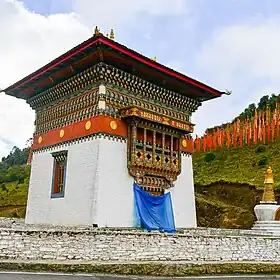 Pelela Chorten lhakhang, c. October 2021 | |
| Elevation | 3,420 m (11,220 ft) |
| Range | Himalayas |
| Coordinates | 27°32′13″N 90°12′08″E / 27.536811°N 90.202116°E |
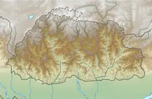 Location of Pele La | |
Pele La (Pele Pass; la means pass in Dzongkha) is a high-mountain motorable pass located in Bhutan.[1]
Location
From Wangdue Phodrang, one can travel east to Pele Pass in Bhutan's central region, which is located at an elevation of 3,420 m (11,220 ft). From its vantage point, on days with clear weather, observers can view Jomolhari soaring at 7,326 m (24,035 ft), Mount Jitchu Drake at 6,662 m (21,857 ft), and Mount Kang Bum standing tall at 6,526 m (21,411 ft).[2]
The pass acts as a demarcation between the western and central regions of the country.[3] Just at the pass, local artisans sell traditional Bhutanese handicrafts and handlooms.[4]
Gallery
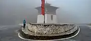 Chorten at Pele La Pass, Central Bhutan, c. March 2023
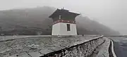 Chorten at Pele La Pass, Central Bhutan, c. March 2023
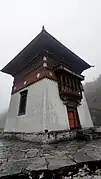 Chorten at Pele La Pass, Central Bhutan, c. March 2023
 Biological Corridor 08, Pele La Pass, Central Bhutan, c. March 2023
See also
References
- ↑ Fitzgerald, Sunny (2022-10-25). "What It's Like to Walk a Trail in the Beautiful Himalayas". Thrillist. Retrieved 2023-06-23.
- ↑ Dreams, Himalayan. "Pele La". www.himalayan-dreams.com. Retrieved 2023-06-23.
- ↑ Melancon, Nicole. "Farm-to-cushion dining along the Trans Bhutan Trail". www.bbc.com. Retrieved 2023-06-23.
- ↑ Wismayer, Henry (2022-12-07). "See the relentless beauty of Bhutan—a kingdom that takes happiness seriously". Travel. Archived from the original on December 7, 2022. Retrieved 2023-06-23.
This article is issued from Wikipedia. The text is licensed under Creative Commons - Attribution - Sharealike. Additional terms may apply for the media files.