Saint-Christophe-de-Chaulieu | |
|---|---|
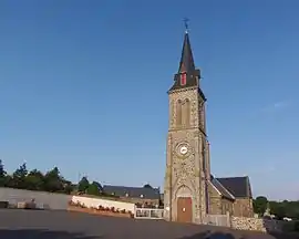 The church in Saint-Christophe-de-Chaulieu | |
Location of Saint-Christophe-de-Chaulieu | |
 Saint-Christophe-de-Chaulieu  Saint-Christophe-de-Chaulieu | |
| Coordinates: 48°44′48″N 0°49′07″W / 48.7467°N 0.8186°W | |
| Country | France |
| Region | Normandy |
| Department | Orne |
| Arrondissement | Argentan |
| Canton | Domfront en Poiraie |
| Government | |
| • Mayor (2020–2026) | Jean-Yves Prieur[1] |
| Area 1 | 6.51 km2 (2.51 sq mi) |
| Population | 92 |
| • Density | 14/km2 (37/sq mi) |
| Time zone | UTC+01:00 (CET) |
| • Summer (DST) | UTC+02:00 (CEST) |
| INSEE/Postal code | 61374 /61800 |
| Elevation | 224–367 m (735–1,204 ft) (avg. 350 m or 1,150 ft) |
| 1 French Land Register data, which excludes lakes, ponds, glaciers > 1 km2 (0.386 sq mi or 247 acres) and river estuaries. | |
Saint-Christophe-de-Chaulieu (French pronunciation: [sɛ̃ kʁistɔf də ʃoljø] ⓘ, literally Saint-Christophe of Chaulieu) is a commune in the Orne department in north-western France.[3]
See also
References
- ↑ "Répertoire national des élus: les maires". data.gouv.fr, Plateforme ouverte des données publiques françaises (in French). 2 December 2020.
- ↑ "Populations légales 2021". The National Institute of Statistics and Economic Studies. 28 December 2023.
- ↑ INSEE commune file
Wikimedia Commons has media related to Saint-Christophe-de-Chaulieu.
This article is issued from Wikipedia. The text is licensed under Creative Commons - Attribution - Sharealike. Additional terms may apply for the media files.