Sainte-Alauzie | |
|---|---|
Part of Castelnau-Montratier | |
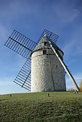 Wind mill, Boisse | |
Location of Sainte-Alauzie | |
 Sainte-Alauzie  Sainte-Alauzie | |
| Coordinates: 44°18′51″N 1°18′57″E / 44.3142°N 1.3158°E | |
| Country | France |
| Region | Occitania |
| Department | Lot |
| Arrondissement | Cahors |
| Canton | Marches du Sud-Quercy |
| Commune | Castelnau-Montratier |
| Area 1 | 12.22 km2 (4.72 sq mi) |
| Population (2019)[1] | 106 |
| • Density | 8.7/km2 (22/sq mi) |
| Time zone | UTC+01:00 (CET) |
| • Summer (DST) | UTC+02:00 (CEST) |
| Postal code | 46170 |
| Elevation | 156–283 m (512–928 ft) (avg. 400 m or 1,300 ft) |
| 1 French Land Register data, which excludes lakes, ponds, glaciers > 1 km2 (0.386 sq mi or 247 acres) and river estuaries. | |
Sainte-Alauzie (French pronunciation: [sɛ̃t alozi]; Languedocien: Senta Alàusia) is a former commune in the Lot department in south-western France.[2] On 1 January 2017, it was merged into the new commune Castelnau-Montratier-Sainte-Alauzie,[3] which was renamed Castelnau-Montratier effective 2024.[4] Its population was 106 in 2019.[1]
See also
References
- 1 2 Téléchargement du fichier d'ensemble des populations légales en 2019, INSEE
- ↑ Des villages de Cassini aux communes d'aujourd'hui: Commune data sheet Sainte-Alauzie, EHESS (in French).
- ↑ Arrêté préfectoral 3 August 2016 (in French)
- ↑ Décret No. 2023-959 du 18 octobre 2023 portant changement du nom de communes
External links
Wikimedia Commons has media related to Sainte-Alauzie.
This article is issued from Wikipedia. The text is licensed under Creative Commons - Attribution - Sharealike. Additional terms may apply for the media files.