Sainte-Françoise | |
|---|---|
 | |
_Quebec_location_diagram.png.webp) Location within Les Basques RCM | |
 Sainte-Françoise Location in eastern Quebec | |
| Coordinates: 48°06′N 69°04′W / 48.1°N 69.07°W[1] | |
| Country | |
| Province | |
| Region | Bas-Saint-Laurent |
| RCM | Les Basques |
| Constituted | December 6, 1873 |
| Government | |
| • Mayor | Simon Lavoie |
| • Federal riding | Rimouski-Neigette—Témiscouata —Les Basques |
| • Prov. riding | Rivière-du-Loup-Témiscouata |
| Area | |
| • Total | 89.40 km2 (34.52 sq mi) |
| • Land | 88.07 km2 (34.00 sq mi) |
| Population | |
| • Total | 399 |
| • Density | 4.5/km2 (12/sq mi) |
| • Pop 2006-2011 | |
| • Dwellings | 229 |
| Time zone | UTC−5 (EST) |
| • Summer (DST) | UTC−4 (EDT) |
| Postal code(s) | |
| Area code(s) | 418 and 581 |
| Highways | |
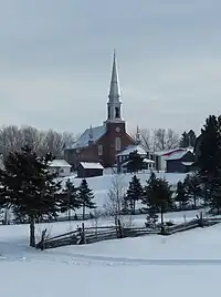
Sainte-Françoise is a parish municipality in the Bas-Saint-Laurent region of Quebec, Canada.
Demographics
| Year | Pop. | ±% |
|---|---|---|
| 1991 | 506 | — |
| 1996 | 467 | −7.7% |
| 2001 | 453 | −3.0% |
| 2006 | 431 | −4.9% |
| 2011 | 399 | −7.4% |
In the 2021 Census of Population conducted by Statistics Canada, Sainte-Françoise had a population of 383 living in 192 of its 209 total private dwellings, a change of -0.8% from its 2016 population of 386. With a land area of 88.83 km2 (34.30 sq mi), it had a population density of 4.3/km2 (11.2/sq mi) in 2021.[5]
Canada census – Sainte-Françoise community profile
| 2021 | 2011 | |
|---|---|---|
| Population | 383 (-0.8% from 2016) | 399 (-7.4% from 2006) |
| Land area | 88.83 km2 (34.30 sq mi) | 88.07 km2 (34.00 sq mi) |
| Population density | 4.3/km2 (11/sq mi) | 4.5/km2 (12/sq mi) |
| Median age | 56 (M: 55.6, F: 56) | 52.6 (M: 53.5, F: 51.6) |
| Private dwellings | 190 (total) | 229 (total) |
| Median household income | $40,716 |
| Canada Census Mother Tongue - Sainte-Françoise, Bas-Saint-Laurent, Quebec[4] | ||||||||||||||||||
|---|---|---|---|---|---|---|---|---|---|---|---|---|---|---|---|---|---|---|
| Census | Total | French |
English |
French & English |
Other | |||||||||||||
| Year | Responses | Count | Trend | Pop % | Count | Trend | Pop % | Count | Trend | Pop % | Count | Trend | Pop % | |||||
2011 |
405 |
395 | 97.53% | 5 | 1.23% | 5 | 1.23% | 0 | 0.00% | |||||||||
2006 |
420 |
410 | 97.62% | 0 | 0.00% | 0 | 0.00% | 10 | 2.38% | |||||||||
2001 |
450 |
450 | 100.00% | 0 | 0.00% | 0 | 0.00% | 0 | 0.00% | |||||||||
1996 |
465 |
465 | n/a | 100.00% | 0 | n/a | 0.00% | 0 | n/a | 0.00% | 0 | n/a | 0.00% | |||||
See also
References
- ↑ "Banque de noms de lieux du Québec: Reference number 56176". toponymie.gouv.qc.ca (in French). Commission de toponymie du Québec.
- 1 2 "Répertoire des municipalités: Geographic code 11030". www.mamh.gouv.qc.ca (in French). Ministère des Affaires municipales et de l'Habitation.
- 1 2 "Sainte-Françoise, Bas-Saint-Laurent, Quebec (Code 2411030) Census Profile". 2011 census. Government of Canada - Statistics Canada.
- 1 2 Statistics Canada: 1996, 2001, 2006, 2011 census
- ↑ "Population and dwelling counts: Canada, provinces and territories, and census subdivisions (municipalities), Quebec". Statistics Canada. February 9, 2022. Retrieved August 29, 2022.
- ↑ "2021 Community Profiles". 2021 Canadian Census. Statistics Canada. February 4, 2022. Retrieved 2022-04-27.
- ↑ "2011 Community Profiles". 2011 Canadian Census. Statistics Canada. March 21, 2019. Retrieved 2014-03-11.
- ↑ "2006 Community Profiles". 2006 Canadian Census. Statistics Canada. August 20, 2019.
- ↑ "2001 Community Profiles". 2001 Canadian Census. Statistics Canada. July 18, 2021.
External links
 Media related to Sainte-Françoise, Bas-Saint-Laurent, Quebec at Wikimedia Commons
Adjacent Municipal Subdivisions | |
|---|---|
| Cities & Towns | |
|---|---|
| Municipalities | |
| Parishes | |
| Unorganized territories | |
| |
This article is issued from Wikipedia. The text is licensed under Creative Commons - Attribution - Sharealike. Additional terms may apply for the media files.