Sainte-Geneviève-sur-Argence | |
|---|---|
Part of Argences-en-Aubrac | |
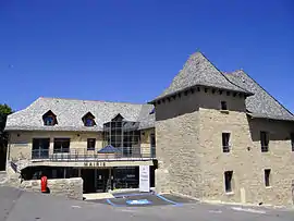 Town hall | |
.svg.png.webp) Coat of arms | |
Location of Sainte-Geneviève-sur-Argence | |
 Sainte-Geneviève-sur-Argence  Sainte-Geneviève-sur-Argence | |
| Coordinates: 44°48′10″N 2°45′33″E / 44.8028°N 2.7592°E | |
| Country | France |
| Region | Occitania |
| Department | Aveyron |
| Arrondissement | Rodez |
| Canton | Aubrac et Carladez |
| Commune | Argences-en-Aubrac |
| Area 1 | 43.4 km2 (16.8 sq mi) |
| Population (2018)[1] | 972 |
| • Density | 22/km2 (58/sq mi) |
| Time zone | UTC+01:00 (CET) |
| • Summer (DST) | UTC+02:00 (CEST) |
| Postal code | 12420 |
| Elevation | 316–928 m (1,037–3,045 ft) (avg. 800 m or 2,600 ft) |
| 1 French Land Register data, which excludes lakes, ponds, glaciers > 1 km2 (0.386 sq mi or 247 acres) and river estuaries. | |
Sainte-Geneviève-sur-Argence (Languedocien: Sant Jurvèva) is a former commune in the Aveyron department in southern France. On 1 January 2016, it was merged into the new commune of Argences-en-Aubrac.[2]
Population
| Year | Pop. | ±% |
|---|---|---|
| 2004 | 1,019 | — |
| 2006 | 1,020 | +0.1% |
| 2007 | 1,015 | −0.5% |
| 2008 | 1,011 | −0.4% |
| 2009 | 1,007 | −0.4% |
| 2010 | 1,003 | −0.4% |
| 2011 | 996 | −0.7% |
| 2012 | 988 | −0.8% |
| 2013 | 977 | −1.1% |
See also
References
Wikimedia Commons has media related to Sainte-Geneviève-sur-Argence.
This article is issued from Wikipedia. The text is licensed under Creative Commons - Attribution - Sharealike. Additional terms may apply for the media files.