Sirutiškis | |
|---|---|
Village | |
 | |
 Sirutiškis Location in Lithuania 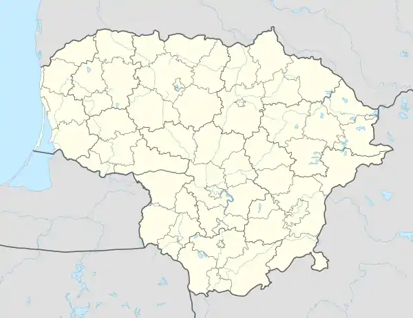 Sirutiškis Sirutiškis (Lithuania) | |
| Coordinates: 55°21′11″N 23°58′59″E / 55.35306°N 23.98306°E | |
| Country | |
| County | |
| Municipality | Kėdainiai district municipality |
| Eldership | Surviliškis Eldership |
| Population (2011) | |
| • Total | 370 |
| Time zone | UTC+2 (EET) |
| • Summer (DST) | UTC+3 (EEST) |
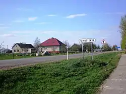
Sirutiškis is a village in Kėdainiai district municipality, in Kaunas County, in central Lithuania. According to the 2011 census, the village has a population of 370 people.[1] It is located 1 km from the Kėdainiai city northern limit (Babėnai), on the right bank of the Nevėžis river, nearby its tributary Baltupis mouth. The regional road ![]() Kėdainiai-Krekenava-Panevėžys runs through the village.
Kėdainiai-Krekenava-Panevėžys runs through the village.
There are a manor palace with a park, library, gravel pit in Sirutiškis.[2]
History
The name Sirutiškis comes from Simonas Sirutis, who was a castellan of Vitebsk and around 1760 had the Sirutiškis manor as an own property. At the 19th century, the manor was a property of the Komarowski family.[3]
Beržytė village was merged with Sirutiškis in 1968.
Demography
|
| ||||||||||||||||||||||||||||||
| Source: 1902, 1923, 1959 & 1970, 1979, 1989, 2001, 2011 | |||||||||||||||||||||||||||||||
Images
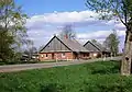 Former manor property in Sirutiškis
 Kutiškiai ancient cemetery on the edge of Sirutiškis
 Sirutiškis manor
References
- ↑ "2011 census". Statistikos Departamentas (Lithuania). Retrieved August 21, 2017.
- ↑ Tarybų Lietuvos enciklopedija (in Lithuanian). Vol. 11. Vilnius: Vyriausioji enciklopedijų redakcija. 1988. p. 4.
- ↑ "Syrutyszki". Geographical Dictionary of the Kingdom of Poland (in Polish). 11. Warszawa: Kasa im. Józefa Mianowskiego. 1890. p. 750.

This article is issued from Wikipedia. The text is licensed under Creative Commons - Attribution - Sharealike. Additional terms may apply for the media files.