| Slate Range | |
|---|---|
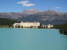 Mt. Richardson seen from Lake Louise | |
| Highest point | |
| Peak | Mount Richardson |
| Elevation | 3,086 m (10,125 ft)[1][2] |
| Prominence | 922 m (3,025 ft)[3] |
| Listing | Mountains of Alberta |
| Coordinates | 51°29′45″N 116°07′21″W / 51.49583°N 116.12250°W[4] |
| Dimensions | |
| Length | 26 km (16 mi) W-E[5] |
| Width | 13 km (8.1 mi) N-S[5] |
| Geography | |
 | |
| Country | Canada |
| Province | Alberta |
| Range coordinates | 51°29′46″N 116°07′20″W / 51.49611°N 116.12222°W[6] |
| Parent range | Canadian Rockies |
| Topo map | NTS 82N8 Lake Louise[6] |
The Slate Range is a mountain range of the Canadian Rockies, located in Banff National Park, Canada. The range is named after slate, the primary composition of the mountains in the area.[7]
The Lake Louise Ski Resort is on the southern slopes of this range.
This range includes the following mountains and peaks:
| Mountain/Peak | Elevation (m/ft) | Prom. (m/ft) | ||
|---|---|---|---|---|
| Mount Richardson | 10,125
style="text-align:right;" data-sort-value="7002922000000000000"|922 |
3,025 | ||
| Ptarmigan Peak | 10,036
style="text-align:right;" data-sort-value="7002209000000000000"|209 |
686 | ||
| Pika Peak | 10,016
style="text-align:right;" data-sort-value="7001130000000000000"|13 |
43 | ||
| Fossil Mountain | 9,665
style="text-align:right;" data-sort-value="7002471000000000000"|471 |
1,545 | ||
| Redoubt Mountain | 9,521
style="text-align:right;" data-sort-value="7002570000000000000"|570 |
1,870 | ||
| Lipalian Mountain | 8,890
style="text-align:right;" data-sort-value="7002152000000000000"|152 |
499 | ||
| Skoki Mountain | 8,881
style="text-align:right;" data-sort-value="7002482000000000000"|482 |
1,581 | ||
| Anthozoan Mountain | 8,842
style="text-align:right;" data-sort-value="7002304000000000000"|304 |
997 | ||
| Brachiopod Mountain | 8,750
style="text-align:right;" data-sort-value="7002152000000000000"|152 |
499 | ||
| Whitehorn Mountain | 8,652
style="text-align:right;" data-sort-value="7002167000000000000"|167 |
548 | ||
| Heather Ridge | 8,648
style="text-align:right;" data-sort-value="7002213000000000000"|213 |
699 | ||
See also
References
- ↑ Kane, Alan (1999). "Mount Richardson". Scrambles in the Canadian Rockies. Calgary: Rocky Mountain Books. p. 250. ISBN 0-921102-67-4.
- ↑ "Topographic map of Mount Richardson". opentopomap.org. Retrieved 2023-07-18.
- ↑ "Mount Richardson". Bivouac.com. Retrieved 2023-07-18.
- ↑ "Mount Richardson". Geographical Names Data Base. Natural Resources Canada. Retrieved 2023-07-18.
- 1 2 "Slate Range". Peakbagger.com. Retrieved 2019-06-11.
- 1 2 "Slate Range". Geographical Names Data Base. Natural Resources Canada. Retrieved 2019-06-11.
- ↑ "Slate Range". cdnrockiesdatabases.ca. Retrieved 2019-06-11.
This article is issued from Wikipedia. The text is licensed under Creative Commons - Attribution - Sharealike. Additional terms may apply for the media files.