Stéblová | |
|---|---|
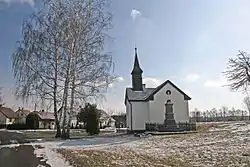 Firehouse | |
 Flag  Coat of arms | |
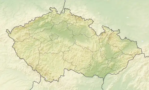 Stéblová Location in the Czech Republic | |
| Coordinates: 50°5′31″N 15°44′46″E / 50.09194°N 15.74611°E | |
| Country | |
| Region | Pardubice |
| District | Pardubice |
| First mentioned | 1385 |
| Area | |
| • Total | 7.84 km2 (3.03 sq mi) |
| Elevation | 223 m (732 ft) |
| Population (2023-01-01)[1] | |
| • Total | 322 |
| • Density | 41/km2 (110/sq mi) |
| Time zone | UTC+1 (CET) |
| • Summer (DST) | UTC+2 (CEST) |
| Postal code | 533 45 |
| Website | www |
Stéblová is a municipality and village in Pardubice District in the Pardubice Region of the Czech Republic. It has about 300 inhabitants.
History
The first written mention of Stéblová is from 1385.[2]
In 1960, Stéblová was the site of the Stéblová train disaster, the largest railway accident in Bohemia. 118 people died.[2]
References
- ↑ "Population of Municipalities – 1 January 2023". Czech Statistical Office. 2023-05-23.
- 1 2 "O obci" (in Czech). Obec Stéblová. Retrieved 2022-07-12.
External links
Wikimedia Commons has media related to Stéblová.
This article is issued from Wikipedia. The text is licensed under Creative Commons - Attribution - Sharealike. Additional terms may apply for the media files.