Stambach | |
|---|---|
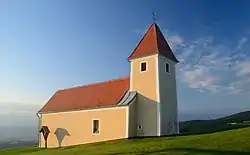 St.Pankrazen church on the eastern slope of Masenberg in Stambach | |
 Coat of arms | |
 Stambach Location within Austria | |
| Coordinates: 47°20′2.6″N 15°57′30.2″E / 47.334056°N 15.958389°E | |
| Country | Austria |
| State | Styria |
| District | Hartberg-Fürstenfeld |
| Government | |
| • Mayor | Johann Rechberger (ÖVP) |
| Area | |
| • Total | 20.59 km2 (7.95 sq mi) |
| Elevation | 609 m (1,998 ft) |
| Population (1 January 2016)[1] | |
| • Total | 632 |
| • Density | 31/km2 (79/sq mi) |
| Time zone | UTC+1 (CET) |
| • Summer (DST) | UTC+2 (CEST) |
| Postal code | 8232 |
| Area code | 03338 |
| Vehicle registration | HB |
| Website | www.stambach. steiermark.at |
Stambach is a former municipality in the district of Hartberg-Fürstenfeld in Styria, Austria. Since the 2015 Styria municipal structural reform, it is part of the municipality Grafendorf bei Hartberg.[2]
References
This article is issued from Wikipedia. The text is licensed under Creative Commons - Attribution - Sharealike. Additional terms may apply for the media files.