| Storwood | |
|---|---|
 Hagg Bridge | |
 Storwood Location within the East Riding of Yorkshire | |
| OS grid reference | SE711442 |
| Civil parish | |
| Unitary authority | |
| Ceremonial county | |
| Region | |
| Country | England |
| Sovereign state | United Kingdom |
| Post town | YORK |
| Postcode district | YO42 |
| Dialling code | 01759 |
| Police | Humberside |
| Fire | Humberside |
| Ambulance | Yorkshire |
| UK Parliament | |
Storwood is a hamlet and former civil parish, now in the parish of Cottingwith, East Riding of Yorkshire, England. It is situated approximately 6 miles (9.7 km) south-west of Pocklington and lies to the south of the B1228 road on the south bank of the Pocklington Canal. In 1931 the civil parish had a population of 63.[1] Storwood was formerly a township in the parish of Thornton,[2] in 1866 Storwood became a civil parish, on 1 April 1935 the civil parish was merged with East Cottingwith to create Cottingwith.[3]
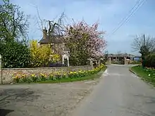
Storwood, looking north towards the manor house
References
Wikimedia Commons has media related to Storwood.
- ↑ "Population Statistics Storwood Tn/CP through time". Vision of Britain. Retrieved 16 June 2018.
- ↑ "History of Storwood, in East Riding of Yorkshire and East Riding". A Vision of Britain through Time. Retrieved 12 August 2023.
- ↑ "Relationships and changes Storwood Tn/CP through time". Vision of Britain. Retrieved 16 June 2018.
- Gazetteer — A–Z of Towns Villages and Hamlets. East Riding of Yorkshire Council. 2006. p. 10.
| Unitary authorities | |
|---|---|
| Major settlements (cities in italics) | |
| Rivers | |
| Canals | |
| Topics | |
This article is issued from Wikipedia. The text is licensed under Creative Commons - Attribution - Sharealike. Additional terms may apply for the media files.