| Tatula | |
|---|---|
 | |
| Location | |
| Country | Lithuania |
| Region | Biržai district municipality, Panevėžys County |
| Physical characteristics | |
| Mouth | Mūša |
• coordinates | 56°07′24″N 24°27′14″E / 56.1234°N 24.4540°E |
| Length | 64.7 km (40.2 mi) |
| Basin size | 453.4 km2 (175.1 sq mi) |
| Basin features | |
| Progression | Mūša→ Lielupe→ Baltic Sea |
| Tributaries | |
| • left | Upytė |
| • right | Vabala, Juodupė |
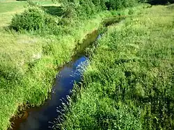
Tatula is a river of Biržai district municipality, Panevėžys County, northern Lithuania. It flows for 64.7 kilometres (40.2 mi) and has a basin area of 453.4 km2 (175.1 sq mi).
References
This article is issued from Wikipedia. The text is licensed under Creative Commons - Attribution - Sharealike. Additional terms may apply for the media files.