Terrats | |
|---|---|
.jpg.webp) The town hall in Terrats | |
Location of Terrats | |
 Terrats  Terrats | |
| Coordinates: 42°36′36″N 2°46′20″E / 42.61°N 2.7722°E | |
| Country | France |
| Region | Occitania |
| Department | Pyrénées-Orientales |
| Arrondissement | Céret |
| Canton | Les Aspres |
| Intercommunality | Aspres |
| Government | |
| • Mayor (2020–2026) | Carine Sales[1] |
| Area 1 | 7.32 km2 (2.83 sq mi) |
| Population | 782 |
| • Density | 110/km2 (280/sq mi) |
| Time zone | UTC+01:00 (CET) |
| • Summer (DST) | UTC+02:00 (CEST) |
| INSEE/Postal code | 66207 /66300 |
| Elevation | 101–230 m (331–755 ft) (avg. 138 m or 453 ft) |
| 1 French Land Register data, which excludes lakes, ponds, glaciers > 1 km2 (0.386 sq mi or 247 acres) and river estuaries. | |
Terrats (French pronunciation: [tɛʁats] ⓘ) is a commune in the Pyrénées-Orientales department in southern France.
Geography
Terrats is located in the canton of Les Aspres and in the arrondissement of Perpignan.
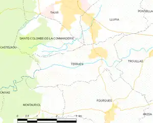
Map of Terrats and its surrounding communes
Population
| Year | Pop. | ±% p.a. |
|---|---|---|
| 1968 | 363 | — |
| 1975 | 366 | +0.12% |
| 1982 | 492 | +4.32% |
| 1990 | 520 | +0.69% |
| 1999 | 528 | +0.17% |
| 2007 | 615 | +1.92% |
| 2012 | 668 | +1.67% |
| 2017 | 640 | −0.85% |
| Source: INSEE[3] | ||
See also
References
- ↑ "Répertoire national des élus: les maires". data.gouv.fr, Plateforme ouverte des données publiques françaises (in French). 2 December 2020.
- ↑ "Populations légales 2021". The National Institute of Statistics and Economic Studies. 28 December 2023.
- ↑ Population en historique depuis 1968, INSEE
Wikimedia Commons has media related to Terrats.
This article is issued from Wikipedia. The text is licensed under Creative Commons - Attribution - Sharealike. Additional terms may apply for the media files.