Tamdybulak
Тамдыбулақ, Tamdibulaq | |
|---|---|
Town | |
| Tamdybulak | |
 Tamdybulak Location in Uzbekistan | |
| Coordinates: 41°45′N 64°37′E / 41.750°N 64.617°E | |
| Country | |
| Region | Navoiy Region |
| District | Tamdy District |
| Elevation | 297 m (974 ft) |
| Population (2022) | |
| • Total | 5,000 |
| Time zone | UTC+5 (UZT) |
Tamdybulaq, sometimes also written as Tamdybulak, is an urban-type settlement and seat of Tamdy District in Navoiy Region in Uzbekistan.[2] Its population is 5,000 (2022 est.).[3]
Geography
Tamdybulak lies in the Kyzyl Kum desert, a flat, arid plain with scattered sand dunes.
Transportation
Tamdybulak is served by the Tamdy Bulak Airport.[4]
Roads from the town lead southwest to Zarafshan, southeast to Ayakkuduk, and north to Sukuti and Keriz.
Climate
Tamdybulak has a desert climate (Köppen climate classification BWk), with cold winters and very hot summers. Rain is light and sporadic, and usually occurs from November to May.
| Climate data for Tamdybulak (1991-2020, extremes 1932-present) | |||||||||||||
|---|---|---|---|---|---|---|---|---|---|---|---|---|---|
| Month | Jan | Feb | Mar | Apr | May | Jun | Jul | Aug | Sep | Oct | Nov | Dec | Year |
| Record high °C (°F) | 22.8 (73.0) |
28.0 (82.4) |
34.0 (93.2) |
40.1 (104.2) |
43.1 (109.6) |
46.0 (114.8) |
48.4 (119.1) |
45.8 (114.4) |
42.7 (108.9) |
38.2 (100.8) |
30.9 (87.6) |
22.5 (72.5) |
48.4 (119.1) |
| Mean daily maximum °C (°F) | 3.1 (37.6) |
6.2 (43.2) |
14.9 (58.8) |
22.9 (73.2) |
30.3 (86.5) |
36.0 (96.8) |
37.8 (100.0) |
36.0 (96.8) |
29.5 (85.1) |
21.2 (70.2) |
11.1 (52.0) |
4.2 (39.6) |
21.1 (70.0) |
| Daily mean °C (°F) | −1.1 (30.0) |
1.1 (34.0) |
8.6 (47.5) |
16.3 (61.3) |
23.4 (74.1) |
29.2 (84.6) |
31.2 (88.2) |
29.1 (84.4) |
22.3 (72.1) |
14.2 (57.6) |
5.7 (42.3) |
0.1 (32.2) |
15.0 (59.0) |
| Mean daily minimum °C (°F) | −4.6 (23.7) |
−3.2 (26.2) |
3.2 (37.8) |
10.2 (50.4) |
16.8 (62.2) |
22.0 (71.6) |
24.1 (75.4) |
22.0 (71.6) |
15.4 (59.7) |
8.1 (46.6) |
1.1 (34.0) |
−3.6 (25.5) |
9.3 (48.7) |
| Record low °C (°F) | −28.2 (−18.8) |
−30.1 (−22.2) |
−24.9 (−12.8) |
−8.0 (17.6) |
0.4 (32.7) |
7.0 (44.6) |
11.6 (52.9) |
7.4 (45.3) |
−1.8 (28.8) |
−11.1 (12.0) |
−24.8 (−12.6) |
−28.2 (−18.8) |
−30.1 (−22.2) |
| Average precipitation mm (inches) | 11 (0.4) |
15 (0.6) |
17 (0.7) |
15 (0.6) |
14 (0.6) |
5 (0.2) |
2 (0.1) |
2 (0.1) |
0.4 (0.02) |
4 (0.2) |
13 (0.5) |
12 (0.5) |
110 (4.3) |
| Average extreme snow depth cm (inches) | 1 (0.4) |
2 (0.8) |
0 (0) |
0 (0) |
0 (0) |
0 (0) |
0 (0) |
0 (0) |
0 (0) |
0 (0) |
0 (0) |
1 (0.4) |
2 (0.8) |
| Average rainy days | 4 | 4 | 6 | 6 | 4 | 2 | 1 | 1 | 1 | 2 | 4 | 4 | 39 |
| Average snowy days | 6 | 4 | 1 | 0.1 | 0 | 0 | 0 | 0 | 0 | 0.1 | 2 | 4 | 17.2 |
| Average relative humidity (%) | 72 | 66 | 56 | 44 | 36 | 28 | 25 | 25 | 30 | 41 | 60 | 71 | 46 |
| Mean monthly sunshine hours | 110.6 | 144.0 | 195.8 | 244.6 | 317.9 | 350.6 | 396.2 | 378.0 | 315.8 | 252.0 | 156.6 | 110.5 | 2,972.6 |
| Source 1: Pogoda.ru.net[5] | |||||||||||||
| Source 2: NOAA[6] | |||||||||||||
References
- ↑ "Tomdibuloq, Uzbekistan". Falling Rain Global Gazetteer. Retrieved 30 January 2013.
- ↑ "Classification system of territorial units of the Republic of Uzbekistan" (in Uzbek and Russian). The State Committee of the Republic of Uzbekistan on statistics. July 2020.
- ↑ "Tandy Bulak Airport". OurAirports. Retrieved 30 January 2013.
- ↑ КЛИМАТ УЛАН-БАТОРА (in Russian). Pogoda.ru.net. Retrieved 4 January 2015.
- ↑ "Climate Normals for Fergana". National Oceanic and Atmospheric Administration. Retrieved 1 November 2023.
Capital: Navoiy | ||
| Districts | 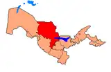 | |
| Cities | ||
| Towns | ||
| Villages | ||
This article is issued from Wikipedia. The text is licensed under Creative Commons - Attribution - Sharealike. Additional terms may apply for the media files.