Valambray | |
|---|---|
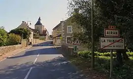 The road into Airan | |
Location of Valambray | |
 Valambray  Valambray | |
| Coordinates: 49°06′04″N 0°09′07″W / 49.101°N 0.152°W | |
| Country | France |
| Region | Normandy |
| Department | Calvados |
| Arrondissement | Caen |
| Canton | Troarn |
| Intercommunality | Val ès dunes |
| Government | |
| • Mayor (2020–2026) | Patrice Martin[1] |
| Area 1 | 41.16 km2 (15.89 sq mi) |
| Population | 1,682 |
| • Density | 41/km2 (110/sq mi) |
| Time zone | UTC+01:00 (CET) |
| • Summer (DST) | UTC+02:00 (CEST) |
| INSEE/Postal code | 14005 /14370 |
| 1 French Land Register data, which excludes lakes, ponds, glaciers > 1 km2 (0.386 sq mi or 247 acres) and river estuaries. | |
Valambray (French pronunciation: [valɑ̃bʁɛ]) is a commune in the department of Calvados, northwestern France. The municipality was established on 1 January 2017 by merger of the former communes of Airan (the seat), Billy, Conteville, Fierville-Bray and Poussy-la-Campagne.[3]
See also
References
Wikimedia Commons has media related to Valambray.
- ↑ "Répertoire national des élus: les maires" (in French). data.gouv.fr, Plateforme ouverte des données publiques françaises. 13 September 2022.
- ↑ "Populations légales 2021". The National Institute of Statistics and Economic Studies. 28 December 2023.
- ↑ Arrêté préfectoral 8 September 2016 (in French)
This article is issued from Wikipedia. The text is licensed under Creative Commons - Attribution - Sharealike. Additional terms may apply for the media files.