Viktorsberg | |
|---|---|
 | |
 Coat of arms | |
 Location in the district | |
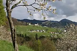
 Viktorsberg Location within Austria | |
| Coordinates: 47°17′N 09°40′E / 47.283°N 9.667°E | |
| Country | Austria |
| State | Vorarlberg |
| District | Feldkirch |
| Government | |
| • Mayor | Philibert Ellensohn |
| Area | |
| • Total | 12.51 km2 (4.83 sq mi) |
| Elevation | 879 m (2,884 ft) |
| Population (2018-01-01)[2] | |
| • Total | 411 |
| • Density | 33/km2 (85/sq mi) |
| Time zone | UTC+1 (CET) |
| • Summer (DST) | UTC+2 (CEST) |
| Postal code | 6832 |
| Website | http://www.viktorsberg.at |
Viktorsberg is a municipality in the district of Feldkirch in the Austrian state of Vorarlberg.
Population
| Year | Pop. | ±% |
|---|---|---|
| 1869 | 196 | — |
| 1880 | 209 | +6.6% |
| 1890 | 203 | −2.9% |
| 1900 | 251 | +23.6% |
| 1910 | 234 | −6.8% |
| 1923 | 232 | −0.9% |
| 1934 | 232 | +0.0% |
| 1939 | 257 | +10.8% |
| 1951 | 271 | +5.4% |
| 1961 | 313 | +15.5% |
| 1971 | 352 | +12.5% |
| 1981 | 363 | +3.1% |
| 1991 | 378 | +4.1% |
| 2001 | 378 | +0.0% |
| 2011 | 377 | −0.3% |
References
- ↑ "Dauersiedlungsraum der Gemeinden Politischen Bezirke und Bundesländer - Gebietsstand 1.1.2018". Statistics Austria. Retrieved 10 March 2019.
- ↑ "Einwohnerzahl 1.1.2018 nach Gemeinden mit Status, Gebietsstand 1.1.2018". Statistics Austria. Retrieved 9 March 2019.
Wikimedia Commons has media related to Viktorsberg.
This article is issued from Wikipedia. The text is licensed under Creative Commons - Attribution - Sharealike. Additional terms may apply for the media files.