Villafufre | |
|---|---|
.svg.png.webp) Flag .svg.png.webp) Seal | |
 Villafufre Location in Spain. | |
| Coordinates: 43°16′02″N 3°53′31″W / 43.26722°N 3.89194°W | |
| Country | Spain |
| Autonomous community | Cantabria |
| Area | |
| • Total | 30.1 km2 (11.6 sq mi) |
| Elevation | 750 m (2,460 ft) |
| Population (2018)[1] | |
| • Total | 1,029 |
| • Density | 34/km2 (89/sq mi) |
| Time zone | UTC+1 (CET) |
| • Summer (DST) | UTC+2 (CEST) |
| Website | www.villafufre.com |
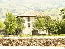
A Building in Villafufre, Cantabria, Spain
References
- ↑ Municipal Register of Spain 2018. National Statistics Institute.
- ↑ es:Anexo:Municipios de Cantabria
This article is issued from Wikipedia. The text is licensed under Creative Commons - Attribution - Sharealike. Additional terms may apply for the media files.